Projects

Research

The financing of INCD GeoEcoMar’s research activity is carried out by participating in domestic and international tenders or by direct contracting with partners from the country or abroad.

In order to increase the scientific and technical capacity of INCD GeoEcoMar, the following main funding directions are pursued: internal project competitions organized by the Ministry of Education and Research or other ministries or government agencies, structural funds, extra-budgetary sources and attracted ones (eg donations, sponsorships).

List of projects in alphabetical order (A–Z)

The main objective of ACTiON is to establish how an efficient infrastructure, connecting CO2 sources with CO2 geological storage and non-geological utilization options, can be developed as part of regional decarbonisation efforts. ACTiON aims to research and develop a multitemporal integrated assessment model that will support stakeholders in the planning and design of large-scale, flexible CO2 transport, utilisation and storage networks. ACTiON will address geological and engineering constraints, the impact of economic conditions and regulatory environment, as well as the unavoidable uncertainties in defining them. A thorough understanding of the impact of flow phenomena on network design and operation is essential to de-risk the integrated operation by building in flexibility and resilience in response to operational changes in different parts of the chain. Will demonstrate the interplay between such issues by combining them into integrated component models for optimisation of transport, storage and utilisation networks. Complex subsurface and engineering features and processes, such as geological flow barriers, geo-mechanical constraints and well performance, will be implemented as modular computationally independent proxy models to provide the building blocks for integrated models. ACTION will consider networks that link multiple suppliers of CO2 to multiple injection wells and storage locations including depleted fields, saline aquifers and EOR. ACTION will aim to provide the building blocks and workflows for network developers, as basis for efficient design and safe operations. The multitemporal modelling capabilities will be applied to a number of case studies that cover approaches to CCUS network development in different EU Member States, the US and Canada. Pipeline and ship transport will be included, as will be networks of different complexity aiming to support the development of fit-for-purpose, future-proof CO2 transport, utilization and storage networks.

The ALIGN-CCUS project aims to accelerate the transition of the current industrial and energy sectors towards a future in which their economic activities will produce low carbon emissions, in which carbon capture, use and storage (CCUS) will play a key role. ALIGN addresses specific issues in the CCUS chain for industrial regions in ERA-NET countries, allowing for the large-scale implementation of the effective implementation of CCUS by 2025.

Within this project, in addition to the implementation of consolidation mechanisms for the traditional research directions of INCD GeoEcoMar, provided for in the Institutional Development Strategy, it is envisaged the stimulation of the emergence of new directions and research topics, fields that respond to current challenges at a global level and to use the new technologies currently available for the researchers, thus:

  • the balanced development of the RDI staff with teams of INCD GeoEcoMar specialists, in the fields related to the institute’s main direction of research-development-innovation, the study of old and current marine-coastal-deltaic and fluvial systems;
  • the development of the specialization process in the narrow geological, ecological, biological, geochemical and geophysical subfields, in parallel with training in interdisciplinary fields (including innovation management, research marketing, intellectual property);
  • specializations for carrying out multidisciplinary analyzes of emerging pollutants in the Danube – Danube Delta – Black Sea system (eg microplastics, substances with a harmful impact on organisms);
  • the development of innovation activity, by making inventions related to devices, equipment and methods, useful in various research directions of the institute, e.g.: seismoacoustics, magnetometry, gravimetry, mineralogy, paleontological studies, sedimentology, pollution in the coastal, deltaic and fluvial areas , geoarchaeology;
  • deepening the concept of “green” protection against floods and/or erosion;
  • the development of research in bioinformatics analysis, with applications in molecular biology and Environmental DNA (eDNA) for the purpose of investigating aquatic communities;
  • specializations in integrated investigations in the fields of geology, geophysics and biogeochemistry for the analysis of processes and phenomena that take place in the abyssal part of the Black Sea;
  • expansion of archaeogeophysics studies in the submarine field;
  • because in INCD GeoEcoMar a large amount of data is acquired through the specific activities, it is necessary to analyze large data flows; therefore, knowledge will be improved in the following areas:
    • methods of ordering and obtaining statistical information;
    • data quality assessment;
    • management of data gaps;
    • data grouping operations;
    • methods applicable to calendar date data.

The project focuses on two domains – Inland Water Management and Ecosystem and biodiversity monitoring, because these two domains are related, also making it easier for end-users to use the results.

Furthermore, relevant guidelines, regulations, and governmental strategies already integrate the two domains. This applies for example to the Green Deal, the European Water Framework Directive, and the EU Biodiversity strategy for 2030.

The project will have three test sites: Forth catchment in the United Kingdom, Volkerak-Zoommeer in the Netherlands and the Danube Delta in Romania.

Within the framework of the contract, GeoEcoMar had the responsibility to participate as an expert in macrozoobentos in the Joint Black Sea Surveys 2019 of the EMBLAS Plus project, in charge of supervising all aspects of the sampling, analysis and assessment of macrozoobentos. Moreover, the institute was responsible with the processing of macrozoobenthos data collected from all partners involved in EMBLAS Plus, thus contributing to the setting of threshold values for indicators.


The AQUARIUS project aims to provide access to a comprehensive and diverse suite of integrated research infrastructures in order to address the challenges and explore the opportunities necessary for the long-term sustainability of marine and freshwater ecosystems. AQUARIUS will bring together a diverse portfolio of 57 research infrastructures, facilitating more holistic research on aquatic ecosystems. An online catalogue of research infrastructures will allow visitors to search and view these infrastructures by type and location, learn about access arrangements and training requirements. Transnational access to AQUARIUS infrastructures will be ensured through a competitive call-to-finance process. AQUARIUS will launch two calls for funding, inviting candidates for research and innovation projects that can demonstrate how they will use more research infrastructures to contribute to the objectives of the EU Mission: Restoring our oceans and waters.

  • In December 2013, the EU adopted the work program for the joint implementation strategy (CSI WP) of the MSFD for the period 2014-2018. The joint implementation strategy aims, among other things, to address the shortcomings and drawbacks of the first phase in terms of coherence and comparability of its implementation by Member States within and between the marine regions. The activities highlighted for the Black Sea region were: 1) review of the GES definitions and environmental objectives; 2) development of a joint monitoring program; 3) improvement of common understanding and scientific knowledge on some specific descriptors; 4) development of tools to facilitate the exchange of information, reporting and public participation; 5) development of a coordinated Program of Measures ; 6) improving links with existing and new instruments under other Directives; 7) taking into account the possible role and involvement of the Regional Seas Conventions and EEA.
  • During a meeting organized by the European Commission to discuss the recommendations in the evaluation reports referred to the Article 12, focused on regional level, Romania and Bulgaria agreed to work together to improve the adequacy and coherence of the implementation of the MSFD. In 2014, the Commission established that continued support would be needed to make significant progress in the Black Sea. Bulgaria and Romania agreed to start by reviewing and developing coherent GES definitions, environmental objectives and identifying common indicators. The two EU countries also agreed to develop coordinated action programs taking into account the work carried out under the supporting project Arcadis contract – phase I and the Bucharest Convention, as well as to take into account joint measures whenever possible.
  • The purpose of the contract was to support Bulgaria and Romania in developing joint and/or coordinated measures to be taken into account in the development of their national program of measures.

In 2022 and 2023, GeoEcoMar implemented the project “Assistance in Integrated River-Sea Systems Management”, aimed at supporting the Escuela Superior Politécnica del Litoral – ESPOL (Republic of Ecuador). The project focused on knowledge transfer and training of Ecuadorian specialists in the sediment management and integrated management of the coasts of Ecuador and the Guayas Estuary – specific ecosystems under significant anthropogenic pressure, also suffering from severe coastal erosion. Bilateral working visits and research stages in Romania were organized for young ESPOL researchers. The collaboration has opened opportunities for joint participation in Horizon Europe projects and for Ecuador’s potential accession to the pan-European research infrastructure DANUBIUS-RI. The project was funded by the Romanian Agency for International Cooperation for Development (RoAid)

The future of the Black Sea is a key priority for the European Union. The Burgas Vision Paper issued in May 2018, under an initiative supported by the European Commission, outlines the key framework to ensure the sustainable development of the Black Sea by 2030. It focusses on the creation of a Strategic Research and Innovation Agenda (SRIA) based on the identification of critical research problems. The 2019 “Bucharest Declaration” of the scientific community launched the Strategic Research and Innovation Agenda (SRIA) for the Black Sea. Black Sea CONNECT is a key H2020 Coordination and Support Action (CSA) which addressed the development of scientifically, technically and logistically support for the broader Black Sea Blue Growth Initiative, supported by the European Commission (EC) and composed of country-appointed experts, stakeholders and various national and international organizations.

Black Sea CONNECT was the first project in its own field for Black Sea. The initiative has strengthened connections among Black Sea countries, paving the way for long-term regional cooperation and sustainable growth.

The overall objective of the Black Sea CONNECT was to coordinate the development of the Strategic Research and Innovation Agenda (SRIA), based on the defined principles in the Burgas Vision Paper, and support the development of the Blue Economy in the Black Sea.

The SRIA and its Implementation Plan will guide stakeholders from academia, funding agencies, industry, policy, and society to address together the fundamental Black Sea challenges, to promote the blue economy and its prosperities of the Black Sea region, to build critical support systems and innovative research infrastructure and to improve education and capacity building.

BRIDGE-BS project aims to develop the tools and predictive capabilities needed to understand and predict the impact of both climatic and anthropogenic multiple stressors on the ecosystem services provided by the Black Sea. These ecosystem services and their responses to stressors will be mapped, monitored and modelled to identify a safe operating space in which a sustainable blue economy can thrive. Thus, BRIDGE-BS is structured around „three” interconnected nodes – “Dynamics of ecosystem services”, „Blue Growth Incubators” and „Responsible Citizens”. Node 1 will assess, predict and determine ecosystem resilience, using data time series, simulations, and machine learning tools to provide adaptive management tools. Node 2 will identify services that can support Sustainable Blue Growth in the Black Sea by strengthening resource management, developing and applying innovative technologies, and supporting start-ups and innovative business models to create added value and jobs. Node 3 will support the uptake of scientific results provided by BRIDGE-BS into sectoral policies and will train and strengthen the collaborations between scientists and stakeholders, as well as between policy makers, industry and civil society representatives. Most importantly, through Node 3, BRIDGE-BS will create a connected Black Sea community, strengthened by a new generation of researchers and innovators, to address the emerging challenges of the Black Sea.

The CCI Lakes project consisted of producing and validating key variables for the assessment of the effects of climate change in lakes around the world and is part of the European Space Agency’s initiative to study climate change. These variables were: water temperature and water level, water extent, ice cover and water colour. Variables were obtained through satellite data from the 1990s to the present day and had constituted the most time-extensive databases of this kind. The first sets of variables, obtained within the project, were published in 2020 for a set of over 250 lakes.

The project studied the lagoons, deltas and estuaries, the transitional areas between rivers and seas. Its main objective was to improve and harmonize methods of studing surface waters by using satellite data and in-situ measurements. CERTO investigated water parameters used to assess the quality status of all transitional aquatic environments. The project provided services that could be used by environmental quality monitoring agencies, by those working in the field of environmental policies, by various private companies, as well as by the general public. The main result of the project was a system ready to be implemented in the Copernicus services or in other specific softwares.


The project focuses on the lagoons, deltas and estuaries, which are the transition areas between rivers, streams and seas. The objective of the project is to improve and harmonize the studying methods for the surface waters, using satellite data and in-situ measurements. CERTO will investigate the water parameters that can be used to assess the quality status of all transitional aquatic environments. The project will provide services that can be used by the environmental quality monitoring agencies, by those working in the field of environmental policies, by various private companies, but also by the general public. The main result of the project will be a system ready to be implemented in the Copernicus services or specific software.


The project aimed to increase the capacity of GeoEcoMar to participate in the European Union’s Research Framework Programmes (Horizon 2020 and Horizon Europe) by setting up a support structure for researchers called “The Support Center for European and International R&D Projects”, without legal personality within the GeoEcoMar’s Project Management and Marketing Office.

CO2-HyBrid is focusing on the demonstration of next level CCS technologies in major CO2-emitting industries. This will lead to a 20% more efficient CO2 Capture process compared to the state-of-the-art capture technologies. The main objective of CO2-HyBrid is the scale up and demonstration of a hybrid solution based on a membrane pre-concentration step and chemical absorption polishing step. Two membrane types, and two solvents will be used to produce two hybrid configurations to be tested in two test sites with different industrial gas properties (coal/natural gas fired power plant and Waste2Energy pilot installations). The CO2-HyBrid project aims to bring the membrane technologies and hybrid solution to TRL 6.

CO2-Hybrid will strongly contribute to the decarbonization of the energy system in a sustainable, resource efficient way, as membranes, in the first stage, have a very low footprint and their operation is sustainable as it has low energy consumption and no impurities in the main stream, in the second stage, chemical absorption process have a higher rate to capture CO2 with a lower thermal energy consumption for chemical solvent regeneration. Due to the separation of the impurities (dust, SO2, O2, etc.) in the membrane process, the degradation of the chemical solvents will be avoided.


Coast-Scapes (rethinking COASTal landSCAPES with climate-resilient interventions: systemic land-to-sea solutions) proposes to rethink land-coast-sea systems under climate change for enhanced resilience and biodiversity gains. It seeks to develop and transfer climate resilient solutions, often discussed but seldom implemented in a systemic manner, for the land-coast-sea continuum, demonstrating co-benefits across: a) socioeconomic sectors b) geographical domains c) temporal scales.

By combining Core Pilots, to demonstrate and implement systemic solutions, Replicating Pilots, to export resilience plans and Transfer Pilots, to prove the scalability of the approach, COAST-SCAPES supposes a quantum leap for climate resilience.

GeoEcoMar co-leads the Danube Delta Replication Pilot, bringing scientific expertise and local knowledge to adapt and test systemic resilience solutions in this transboundary ecosystem. In parallel, GEM leads dissemination and training under WP5, delivering workshops, e-learning, and certification to empower administrations, practitioners, and civil society.


The Ministry of Environment, Water and Forests launched during the summer of 2022 the procedure for consultancy procurement and technical expertise services for the Development of the National Strategy on Integrated Coastal Zone Management and the Integrated Coastal Zone Management Plan. The Integrated Coastal Zone Management (ICZM) is one of the best known and applied political and legislative tools concerning the coastal zones, used by decision-makers around the world and promoted by international organizations such as the European Commission (e.g. the Council Recommendation on Integrated Coastal Zone Management of 2002, the Barcelona Convention on Integrated Coastal Zone Management Protocol, ratified by the EU in 2010 and the new EU initiative on Maritime Spatial Planning and Integrated Coastal Zone Management of 2013).

INCD GeoEcoMar and Ovidius University in Constanța participated in the acquisition procedure in association, being declared winners of the tender. The technical proposal includes: the approach and methodology for the provision of services; the work plan for the implementation/performance of services/obtaining results under the contract; the proposed staff and the management of the provision of services; the method of making records and the records made in relation to performance indicators; the measures applicable by the bidder during the contract period to ensure the fulfillment of obligations in the social and labor relations field; the information on possible changes to the bidding economic operator; the annexes (GANTT chart, key expert documents, non-key expert documents).

In December 2013, the EU adopted the work programme for the joint implementation strategy (CSI WP) of the MSFD for the period 2014-2018. The joint implementation strategy aims, among other things, to address the shortcomings and deficiencies of the first phase in terms of coherence and comparability of its implementation by Member States within and between marine regions. The activities highlighted for the Black Sea region were: 1) review of the GHG and targets; 2) development of a (joint) monitoring programme; 3) improvement of common understanding and scientific knowledge on some specific descriptors; 4) development of tools to facilitate information exchange, reporting and public participation; 5) development of a (coordinated) programme of measures; 6) improvement of links with existing and new instruments under other directives; 7) consideration of the role and possible involvement of the RAC, EEA and ICES.

At a meeting organised by the European Commission to discuss the recommendations of the regionally focused Article 12 evaluation reports, Romania and Bulgaria agreed to work together to improve the adequacy and coherence of MSFD implementation. The Commission established in 2014 that continued support would be needed to make significant progress in the Black Sea. Bulgaria and Romania agreed to start reviewing and developing coherent definitions of GHG, environmental objectives and the identification of common indicators. The two EU Member States also agreed to develop coordinated programmes of measures taking into account the work done under the support project (phase I) and under the Bucharest Convention, as well as to consider joint measures wherever possible.

The purpose of the contract is to support Bulgaria and Romania in developing joint and/or coordinated measures, to be taken into account in the development of their programme of measures.

Using a bottom-up approach, the project addressed the local stakeholders engaged in different sectors of the maritime economy across all EU regional seas aiming to gather examples of greening traditional business operations or starting new green businesses. This approach included questionnaires and open interviews addressed to industry bodies and associations, port authorities, small and medium-sized enterprises, NGOs, etc. These actions aimed at acquiring the experiences gained from the successful examples in order to create a portfolio with the relevant information for the reproduction of the successful examples elsewhere in the EU, as well as to learn from the unsuccessful examples (understanding/knowing the factors that led to their failure). To increase the relevance of the result for MSFD implementation, the identified examples were characterized according to the type of environmental pressure they address – pressure generated by fishing, the presence of marine litter, changes in hydrographic conditions, pollution or noise, etc. Based on this information, the project identified the ways in which regional, national and EU policies could enable and support such activities. The main objective was to explore the knowledge and experience of the economic actors involved, to make the “blue economy” greener in a profitable way, either by introducing innovative products or by changing the way economic operators operate in the different maritime sectors.

Recently CCS value chain started considering ships for direct injection, not only transport. The CTS project will evaluate the global potential of this technology for facilitating permanent CO2 storage using case studies from offshore on the Norwegian Continental Shelf, Baltics, Black Sea and Atlantic coast of Portugal. CTS will study the impact of direct injection from ship on the definition of capture clusters and storage facilities by developing CCS scenarios in four different offshore regions in Europe. The efficiency of the scenarios from the perspective of cost and abated CO2 emissions compared to existing plans and scenarios will be evaluated.

One of the project goals is to advance direct ship injection technology further together with NEMO Maritime – the industrial partner developing one of such solutions. Direct ship injection is a flexible and low cost solution that can help accelerate CO2 storage and contribute to reducing emissions already by 2030. CTS aims at improving cost and efficiency along the value chain; developing new markets by better addressing the need of smaller emitters; increasing LCA and TEA knowledge for the value chains in selected areas.

By utilizing offshore storage and building trustful communication with stakeholders in selected geographical locations, CTS also aims to contribute to strengthening the acceptance of CCUS technologies.

The main impact of the project is to provide a technology that will allow to decrease costs, reduce conflicts with other marine activities and increase flexibility for early start of CO2 injection in offshore regions, therefore addressing some of the major issues that can hinder the deployment of CCS in Europe on a scale able to deliver required mitigations before 2030.

The project aims to engage new stakeholders in four offshore regions through versatility, flexibility and cost efficiency of direct CO2 injection from ship for permanent storage. The key outcome is design of a full CCUS value chain including direct injection from ship, with engagement of the stakeholders along it. Creation of a full value chain design will promote stakeholder engagement and create a platform for evaluation of the business cases by individual stakeholders by giving them a realistic scenario to adhere to.

The outcomes should help to increase roll-out of the CCS value chains not only through technological advantages of direct ship injection, but also by reducing the threshold for smaller emitters and unlocking offshore storage potential in sites becoming commercial due to lower capex and opex of direct ship injection. Generally, CTS contribution is to map potential emitters, prepare conceptual design of the value chain with a focus on ship design, wells, and storage site.

The project’s general objective is to enhance the participation of Romanian consortia and organizations in the activities of the pan-European infrastructure DANUBIUS-RI, focusing on integrated studies related to the sustainable use of bioresources in the Danube–Danube Delta–Black Sea system.

By implementing the planned activities, the project will primarily contribute to consolidating Romania’s role within DANUBIUS-RI, while also fostering the development of scientific potential in a region that is unique in Europe and of significant interest to the European scientific community—the Danube Delta, a natural laboratory of European importance.


DANS2 project is a support project for the DANUBIUS-RO project and has as main objective the transmission of the final form of the application to the European Commission, which involves, besides the technical and financial documentation (European feasibility study, cost-benefit analysis, demand analysis), a series of specific studies. In addition and in order to comply with the limits imposed by the ESFRI statute (10 years from the entry on the roadmap), DANS2 project has foreseen the following actions to prepare for the launch of the implementation period of the Romanian pan-European infrastructure construction activities DANUBIUS-RI:

– Procurement of services for the writing of the service procurement documentation: execution of construction works, supervision of construction works, management and financial reporting, legal advice, technical consultancy for the writing of  documentation and assistance during the initiation and conduct of award procedures until the completion of the implementation of the DANUBIUS-RI project;

–  Acquisition of DDE design services, external design verification, software development for the management of research activity in the Hub’s laboratories;

– Benchmarking for research equipment and development of technical specifications;

– Updating the technical-financial planning – Study for the exterior design of the Hub location.

The project aims to prepare Romanian participation in the DANUBlUS-Rl project in optimal conditions and to expand the network of potential new users of the infrastructure by identifying, contacting, obtaining new letters of support, carefully following and taking into account their feedback in future developments.

The DANS2 project is a continuation of the DANS project, which was financed from the state budget, so it finances all the studies that are missing to complete the European application and obtain the funding for the major DANUBIUS-RO project: EIA (Environment Impact Assessment) Study for the Hub and Supersite; Carbon Footprint Assessment Study for the Hub and Supersite; Study on the safe use and disposal of laboratory chemicals for the Hub and Supersite; Appropriate Assessment Study for Natura 2000 sites for the Supersite; Study on basic elements for assessing the risks and vulnerabilities to climate change adaptation for the Supersite; Nzero energy efficiency – compliance with the European Commission Directive for the Hub and new research stations in the Supersite.

DANS2 is a project that is co-financed by the EUROPEAN UNION from the European Regional Development Fund through the Competitiveness Operational Program 2014-2020. The pan-European distributed infrastructure DANUBIUS-RI addresses Smart Specialization Domain 3: Energy, Environment and Climate Change, Subdomain 3.2 Environment and Climate Change.


  • Preparing the participation of Romania, as coordinator, in the development of the DANUBIUS-RI distributed pan-European infrastructure through the implementation of the Major Project of Structural Funds for the Romanian component of DANUBIUS-RI (Hub, Data Center and the Danube Delta Supersite).
  • The development of the Romanian component of DANUBIUS-RI has the following effects: the in-depth study of the processes that influence the evolution of ecosystems in wetlands – river, delta/lagoon, coastal areas and the sea under the influence of rivers; the development of a knowledge-based economy that will support sustainable economic growth in the Danube – Danube Delta – Black Sea system, while protecting the biodiversity and the characteristic natural ecosystems; master’s, doctoral and post-doctoral programs in collaboration with universities across Europe; conferences, specialized training courses, workshops, summer schools, etc.; e-learning and ecological educational programs for the local communities;

Europe’s rivers are congested. More than a million barriers, like dams, ramps and fords, are causing extensive loss of river connectivity. In addition, human interventions have ecologically degraded a whopping 70 to 90 % of Europe’s floodplain. Despite ambitious EU policy to turn things around, fresh and transitional water ecosystem restoration remains limited. The EU-funded DANUBE4all project will develop a comprehensive restoration action plan for the Danube River basin lighthouse. The project will engage stakeholders, integrating citizens’ interests to support the EU Mission ‘Restore Our Ocean and Waters by 2030’ in an unprecedented cocreation process. The action plan will rely on solid scientific knowledge and new findings to promote ecological status, biodiversity, and ecosystem connectivity improvement.

The DANUBIUS-RI Preparatory Phase (DANUBIUS-PP) has developed the structures and processes to ensure that DANUBIUS-RI can deliver an integrated understanding of the functioning of River-Sea Systems and address the key societal challenges associated with, and opportunities of, RS systems.

DANUBIUS-PP was a three-year project, started in December 2016, funded by the European Union’s Horizon 2020 Research and Innovation Programme under Grant Agreement No 739562 aiming to raise DANUBIUS-RI to the legal, financial and technical maturity required for successful implementation and development


DANUBIUS-IP is a 36-month Coordination and Support Action to support the ongoing development of DANUBIUS-RI – The International Centre for Advanced Studies on River – Delta – Sea Systems – as it proceeds towards its Operational Phase.

DANUBIUS-IP is coordinated by GeoEcoMar (Romania) and brings together experienced partners across Europe in a consortium with complementary areas of multidisciplinary expertise in freshwater and marine research fields.

The project specifically seeks to address recommendations from the recent ESFRI and High- Level Expert Group reports (on DANUBIUS-RI) and make a significant contribution to the expected outcomes and wider impacts of the Horizon Europe Programme. As such the project considers the importance of sustainability of financial commitments, the need to test the funding model and to enhance the visibility of the RI. DANUBIUS-IP will further demonstrate the efficacy of an integrated and interdisciplinary approach embracing a ‘river-sea continuum’ perspective to fill current gaps in the Research and Innovation landscape to address key societal challenges in these environments impacted by anthropogenic pressures and climate change.

The International Center for Advanced Studies on River – Delta – Sea Systems DANUBIUS-RI is a pan-European distributed research infrastructure supporting interdisciplinary research on River-Sea Systems.

DANUBIUS-RI will offer a pan-European Research Infrastructure (RI) to enable state-of-the-art, Research & Innovation in a source to sea perspective and will provide the tools that will deliver holistic understanding of the evolution, functioning and sustainable management of River-Sea Systems. DANUBIUS-RI will offer services that benefit from integrated capabilities across remote and in-situ observational platforms, experimental facilities and test beds, laboratories, modelling tools and resources for Knowledge Exchange.

DANUBIUS-RI’s vision is to achieve healthy River- Sea Systems and advance their sustainable use, in order to live within the planet’s ecological limits by 2050 and thus create a positive societal impact.


DANUBIUS RO-2 project responds to the national commitments assumed by Romania, as the coordinating state of the European research infrastructure DANUBIUS-RI, and supports the transition from the preparatory to the operational phase.

DANUBIUS-RO national infrastructure is currently under development, with the essential components – the Hub, the Danube Delta Supersite and the Data Center being in various stages of technical and logistical preparation -, while in June 2025 the official establishment of DANUBIUS ERIC was internationally recognized.

Within this project, GeoEcoMar is responsible for coordinating the activities for the Work Package 2 (WP2), which aims to strengthen the legal, institutional and administrative framework of the infrastructure in accordance with European ESFRI standards. The aim is to carry out the current activities of DANUBIUS ERIC and to gradually transfer the responsibilities to the DANUBIUS-ERIC staff who will be employed, as well as to develop links with other European research infrastructures.

GeoEcoMar is responsible for organising and operationalising DANUBIUS-ERIC, coordinating ESFRI and ENVRI-BEERI collaborations and maintaining relations with pan-European infrastructures. GeoEcoMar will thus carry out, together with the other partners, the following two activities:

  • Activity 2.1. ERIC international support; All actions needed to organise and operationalise DANUBIUS-ERIC will be coordinated by GeoEcoMar.
  • Activity 2.2. Synergies with other ERICS and ESFRI projects (pan-European research infrastructures) in the field of environment; Coordination of collaborations at the level of ESFRI and ENVRI-BEERI (Board of European Environmental Research Infrastructures) will continue to be ensured by GeoEcoMar in line with the responsibilities previously exercised.

DANUBIUS RO-2 is a support project that has no research activities and is exclusively dedicated to the operational and functional preparation of the national infrastructure, as an integral part of the DANUBIUS-RI network.

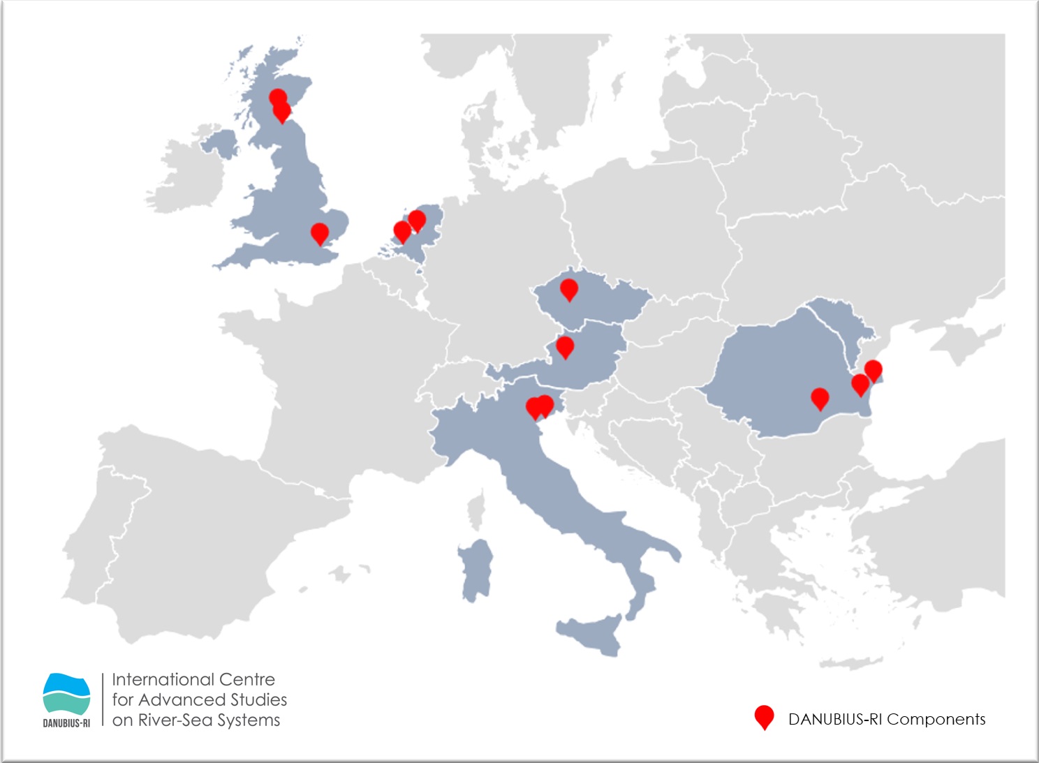
The overall objective of the DANUBIUS-RO project is to build, equip and operationalize the Romanian components of the DANUBIUS-RI pan-European distributed research infrastructure dedicated to river-sea systems for knowledge transfer to stakeholders. DANUBIUS-RI and its Romanian components, which will be built, equipped and operationalized through the DANUBIUS-RO project, address the entire international research community and will bring multiple benefits to Romanian research and to the socio-economic environment of our country. Thus, a national hub will be created for innovation and transfer of knowledge and advanced technologies in the priority area of research on the effects of global change on large river systems, with a focus on transition zones. The DANUBIUS-RO project will transfer research results to the economic environment by partnering with 10 SMEs to develop viable innovative economic solutions.

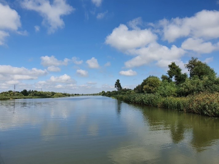
History and necessity of the project.  Why are the Danube and the Danube Delta important for research?

The supporting projects through which, during 2018 and 2023, the documentation to obtain the Completion Note (certifying the completion of the Jaspers – Joint Assistance to Support Projects in European Regions evaluation and compliance with the European Investment Bank’s European funding requirements and recommendations for next steps) has been prepared are the following:

– Strategy and Actions to prepare the National Participation in the DANUBIUS-RI Project, acronym “DANS”, funded under the National Research Plan PN III – coordinated by INCDSB https://dans-suport.ro/;

– DANUBIUS – RI Preparation Support Project, acronym “DANS2”: funded under the Competitive Operational Program 2020-2023 – coordinated by INCDSB https://www.dans2.ro/;

This funding demonstrates the Romanian Government’s support to DANUBIUS-RI to fulfill its commitments.

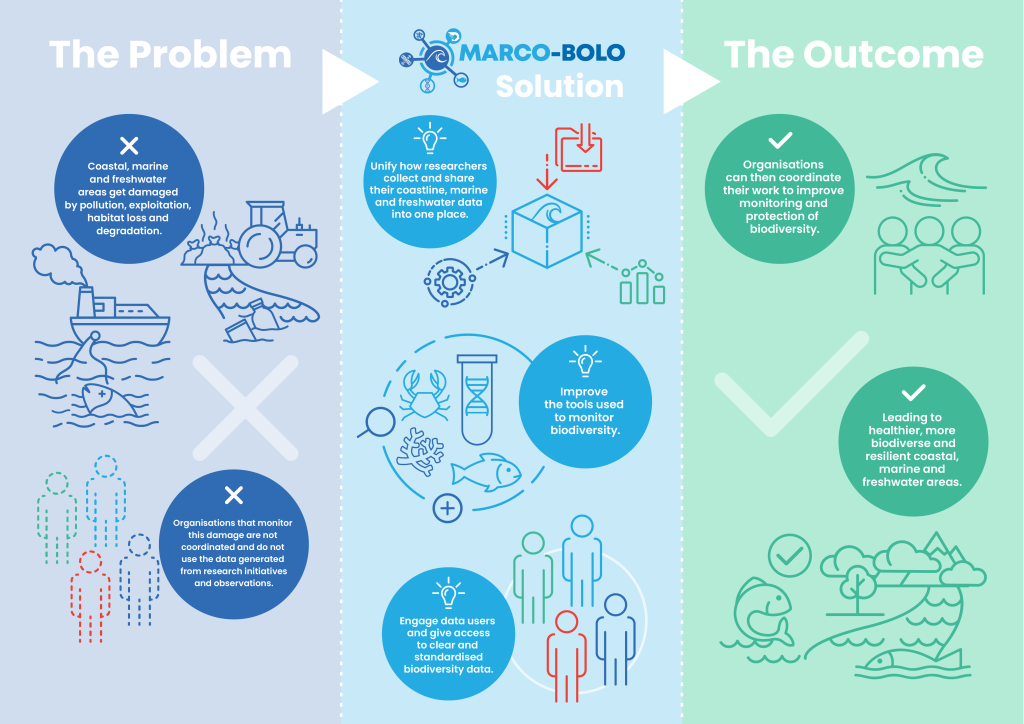
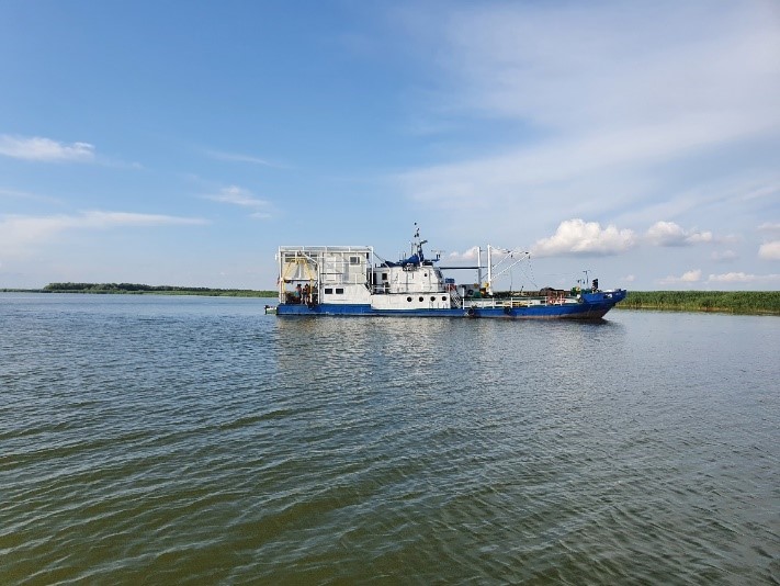
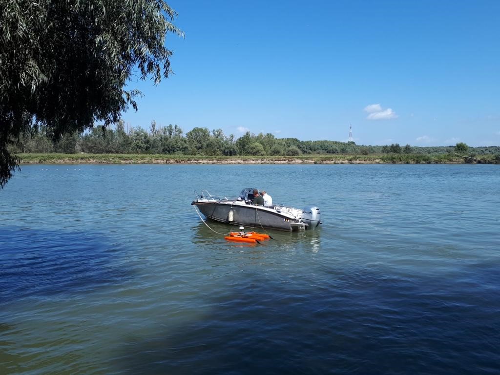
The purpose of DANUBIUS-RO infrastructure – environmental protection, natural resources management, international collaborations

DANUBIUS-RO emphasizes the importance of science in society by linking advanced research with public education and the application of scientific results in industry. Through the initiatives dedicated to education and technology transfer, DANUBIUS-RO promotes a collaborative approach in which the public and industrial stakeholders become active partners in the protection and management of river-sea ecosystems. The concept of “citizen science” is central to this infrastructure, encouraging citizens to participate in data collection and analysis, giving them a direct and practical understanding of the environmental research. This involvement raises awareness and responsibility for ecosystems, and the practical application of scientific findings into industrial and social solutions demonstrates the significant impact of science on the sustainability and well-being of communities.

The DANUBIUS-RO project is supported under Priority 1 of the Smart Growth, Digitization and Financial Instruments Programme, Action 1.2. The project implementation period is 2024-2029.

Among noise sources, maritime traffic is of relevance on animal wellness, although its impact is little known in many European sea-basins. To date, there has been an almost exclusive focus on vertebrates, in which noise involves the mechanoreceptor cells of the ear and can cause hearing impairment or deafness. Homolog cells have been discovered in tunicates, marine invertebrates closely related to vertebrates, thus opening the question on their ability to sense and be affected by noise. Tunicate mechanoreceptors sense sound waves and particle movement and are predictable targets of noise pollution. DeuteroNoise aims to characterize the noise pollution caused by maritime traffic (also using simulations) in selected sites of the North Adriatic Sea, Lagoon of Venice, North Sea, Black Sea, and Barcelona shore, and test its effects on behavior, nervous system and sensory organs, immune system, and resilience in marine invertebrates closely related to vertebrates (deuterostomes): hemichordates, echinoderms, cephalochordates, and tunicates. These animals are common in European seas and cover different levels of the trophic network, from the holoplankton-meroplankton to sessile or sedentary primary consumers. Noise level will be detected on site and simulated in the laboratory. A behavioral, morphological and genetic survey will be conducted on sampled animals living in polluted vs non-polluted areas. Moreover, animals will be exposed to noise in laboratory-controlled conditions to verify its effect on larval, juvenile and adult stages at individual level and over generations. Comparative studies will allow us to: highlight causes of noise pollution in the different basins; determine how species react to it; identify its genetic and morphological signatures; predict sensitivities in closely related animals that cannot easily be studied in laboratory or on-site; predict noise pollution and infer the best practices to reach the Good Environment Status of European basins.


The DOORS Research and Innovation Action developed an optimised open research support system for the Black Sea to: (1) address human and climate change impacts on its fragile and damaged ecosystems and (2) support real behavioural change across its complex geopolitical and governance landscape for Blue Economy development. In doing so, DOORS provided the ambitious framework to overcome the barriers to the advancement of the Blue Economy agenda. DOORS brought together existing fragmented monitoring efforts, delivered state-of-the art observation capability, engaged stakeholders through participatory approaches and established a harmonized capacity-building framework. These outcomes maximise the benefits to all Black Sea communities to promote business growth, well-informed stakeholders and educated citizens.

The overall objective of DOORS is to make the Strategic Research and Innovation Agenda (SRIA) for the Black Sea operational, support the successful implementation of Blue Economy and contribute to a healthy, productive and resilient Black Sea. To fulfil this, DOORS embed stakeholders’ collaboration at its core and developed three Programmes:

  1. Programme-1 System of Systems (SoS) for the Black Sea, a platform for evidence-based knowledge development that was co-designed with policy makers and covers relevant aspects of the physical, chemical, and biological parameters of the Black Sea. The SoS enables a more holistic approach, reflecting the ecosystems services provided, and provides scientific support to the management of the Black Sea.
  2. Programme-2 Blue Growth Accelerator (BGA), identified sectors and entrepreneurs for innovation, provided professional support to unlock their potential, enhanced the exploitation of knowledge, and facilitated access to investors and constructive exchange between scientists, entrepreneurs and policy makers for sustainable development of Blue Economy sectors.
  3. Programme-3 Knowledge Transfer and Training (KTT), built upon on existing, and developed new collaborations, between the different actors on science and policy to promote a culture of openness, share best practice and knowledge. It built capacity to address impacts by engaging stakeholders from the beginning of the project to develop and sustain mutually beneficial collaboration.

DOORS is underpinned by co-development and co-creation of the research and innovation action with key actors from across the Black Sea thus having built mutual trust and understanding which ensured that stakeholder engagement was highly productive.

Recent research on climate conditions in the Cretaceous entered an exciting, multidisciplinary phase, in which geological, sedimentological, geochemical, mineralogical and paleontological approaches were integrated, and a better view of the climate change evolution during the warming intervals was achieved. The project’s theme thus became part of the current research on global warming. The extreme heat of certain Cretaceous intervals represented one of the best examples of “greenhouse” climate conditions in the geological record. The results of multidisciplinary studies (sedimentological, paleontological and geochemical) in the project provided answers to many of the questions in the field and were also related to the current concerns.  Due to the complete geological evidence from the Cretaceous stage and their paleontological wealth, the Carpathians in Romania perfectly served as „natural laboratory” for this topic.

Financed under Horizon Europe Framework Programme, EASTERN LIGHTS project is a crucial first step towards a large-scale onshore CCUS cluster in Eastern Europe. This initiative, centered in North West Bulgaria and driven by a powerful collaboration of 19 organisations across 8 countries, will de-risk development by demonstrating CO₂ transport and storage capabilities. By uniting diverse expertise, Eastern Lights aims to eliminate key uncertainties through industrial demonstration, in-depth research, and proactive stakeholder engagement.

Establishing CO2 enhanced Oil recovery Business Advantages in South Eastern Europe (ECOBASE) project aims to develop prospective revenue stream models and business models for CO2-EOR in South Eastern Europe and support the large-scale implementation of CCUS in the region. The project is being carried out in three countries in South Eastern Europe – Turkey, Romania and Greece – with the support of TNO Netherlands and IRIS Norway. ECO-BASE will access the potential of EORStore through the following activities: carrying out an inventory of CO2 sources (potential capture projects) and reservoirs (potential locations for geological storage and for the use of CO2 for the purpose of increasing oil production with permanent storage) in Romania, Turkey and Greece; carrying out EORStore case studies as a reference for the assessment of EOR potential at national level; identifying and carrying out case studies for business plans and revenue streams achieved through CCUS; establishing national roadmaps for CCUS, with an essential role as an accelerator for CO2-EOR; organizing knowledge transfer workshops for CCUS stakeholders.

The 2030 & 2050 Green Deal goals push EU towards integrated solutions & clear targets. EcoDaLLi, embedded in the Mission ‘Restore our Ocean, seas & waters by 2030’ will help achieve freshwater targets of European Green Deal, integrating a systemic approach for restoration, protection & preservation for the entire Danube Basin, provided by coordinated actions.

The general objective of the project is to contribute to the EMODnet operational service by maintaining and enhancing availability and services for the parameters under their responsibility, through the EMODnet Central Portal.

The EMODnet-Bathymetry Portal is being developed within the European Marine Observation and Data Network (EMODnet). The project provides services for discovering and requesting access to the bathymetric data (survey datasets and composite DTMs) that are managed by a growing number of data providers.

EMODnet-Geology project is one of seven projects that bring together information on geology, chemistry, biology, physics, bathymetry, seabed habitats and human activities in the European marine environment. Each project brings together marine data, data products and metadata from a wide range of sources. Within the EMODnet Geology project, the information made available to the network is mainly provided by the project partners, but other organisations also contribute to the geological mapping objectives in many of the participating countries.

The European Marine Observation and Data Network (EMODnet) is funded by the European Union under Regulation (EU) No 508/15.05.2014 of the European Parliament and of the Council on the European Maritime and Fisheries Fund.

The general objective of the project is to contribute to the EMODnet operational service by maintaining and enhancing availability and services for the parameters under their responsibility, through the EMODnet Central Portal.


In the framework of the Phase 3 extension (2019-2021), the EUSeaMap platform will be updated and transposed into new classifications, namely EUNIS 2019, HELCOM HUB (in the Baltic Sea), and the revised classification of Mediterranean habitat types will be also implemented. The map collection will be expanded and used to produce several new composite data products. The first phase of transposition of EUNIS 2007 habitat maps into EUNIS 2019 will also be completed.


The fifth phase of the EMODnet Seabed Habitats project will continue the work on developing Europe’s only habitat map library; create new composite data products showing the extent and distribution of vulnerable marine ecosystems and potentially degraded habitats in and around Europe; update the EMODnet large-scale benthic habitat maps for Europe (EUSeaMap); collaborate with Regional Sea Conventions (RSCs) and ICES Working Groups to provide habitat mapping products for their reporting and monitoring requirements; and maintain and improve common methods of accessing data held in repositories.

The overall objective of this project is to further develop an operational service whereby the marine data and data products built according to common standards can be found, viewed and downloaded in a free and unrestricted way of use.

In the fourth phase (2021–2023), the EMODnet Seabed Habitats project will expand its area of investigation into two new regions: the Caspian Sea and some European Caribbean territories. In this phase, updated versions of the large-scale EMODnet map of marine bental habitats for Europe (EUSEaMap) will be delivered, together with new products for coastal wetlands and essential fish habitats.

The general objective of the project is to contribute to the EMODnet operational service by maintaining and enhancing availability and services for the parameters under their responsibility, through the EMODnet Central Portal.

The general objective of the project is to contribute to the EMODnet operational service by maintaining and enhancing availability and services for the parameters under their responsibility, through the EMODnet Central Portal.

The general objective of the project is to contribute to the EMODnet operational service by maintaining and enhancing availability and services for the parameters under their responsibility, through the EMODnet Central Portal.

The Seabed Habitats project activities will consist of building a habitat support layer, modelled from multiple databases. Analyses will identify biologically relevant threshold values for the variables used to define the boundaries between classes. A new model, required to produce a large-scale EUNIS habitat map at a scale of 1:100,000 or larger, will extend the spatial coverage to include the Barents Sea and other areas where input data coverage allows.

EMSO-Link project aimed to accelerate and establish EMSO ERIC governance rules and procedures and facilitate the coordination of the construction, operation, expansion and maintenance of the EMSO ERIC infrastructure.

The overall objective of EMSODEV was to catalyze all operations of the EMSO ERIC Research Infrastructure for the development and installation of EGIM (EMSO Generic Instrument Module). EGIM provides accurate, complete, comparable and long-term measurements of the ocean parameters, which must meet social and scientific challenges such as climate change and marine hazards. This project has helped to increase the inter-operability of EMSO ERIC nodes and to collect all data in real time in one place.

ENOS strives to enhance the development of CO2 storage onshore, close to CO2 emission points. Several field pilots in various geological settings will be studied in detail and best practices that stakeholders can rely on will be produced. In this way, ENOS will help demonstrate that CO2 storage is safe and environmentally sound and increase the confidence of stakeholders and the public in CCS as a viable mitigation option. Developing, testing and demonstrating in the field, under “real-life conditions”, key technologies specifically adapted to onshore storage.Contributing to the creation of a favourable environment for onshore storage across Europe.

ENVRI-FAIR represents the link between the Environmental Research Infrastructures (ENVRI) cluster and the European Open Science Cloud (EOSC).

The EROVMUS project aims to create an established interface for ROV (remotely operated vehicle) pilots, enabling them to easily and efficiently launch the ROV services in missions related to the identification/location of unexploded underwater munitions stranded on the seabed. These include both a multi-operational platform equipped with a series of sensors and software creating solutions. The activities envisaged are related to navigation improvement, the introduction of autonomous identification routines, as well as high-performance image acquisition technologies. The data obtained from multiple sensors will be overlaid to produce an equivalent of the standard primary Heads UP (HUD) display for the pilot, thus reducing the number of displays that is necessary for efficient operation. Furthermore, solutions for implementing virtual reality (VR) technology will be analysed, allowing the use of virtual displays and the combination of images from multiple cameras to create a single large virtual display to improve ammunition identification. The project will develop, test and optimize a range of tools and assess their interoperability with several existing ROV models and brands. This will create a potential product range that could be implemented by other ROV equipment manufacturers.

The project outcome has the potential to both improve the current technical state of the equipment and to create new jobs, thus improving the European competitiveness in the underwater technology sector.

The project aimed to achieve a synergistic alliance of marine research infrastructures belonging to the 41 participating European and international organizations.

EUROFLEETS2 project represents the continuation and improvement of EUROFLEETS1, aiming to develop a new pan-European distributed research infrastructure with a common strategic vision and coordinated access to research vessels and marine equipment.

EUROFLEETS2 will undertake specific actions aimed at strengthening the organisation, methodology and tools of the vessels through operational experimental tests (such as virtual fleets) leading to a fully interoperable and cost-effective European research fleet.

The project aims to use the research infrastructure framework and concept to successfully support the needs of the river basin community to overcome the current technical state, as well as to support the connection of multiple hydrographic networks and operations, which are currently disconnected. The project will develop the concept of a EuroGO-SHIP research infrastructure to support the needs of ICES, GO-SHIP and other relevant hydrographic observation networks existing in the fulfilment of their missions.

The EuroGO-SHIP project seeks to enable the European community conducting hydrographic observations at sea to provide higher quality and more sustainable data flows to a broad range of end users, more effectively. The project will work towards strengthening European capabilities to deliver world-class Oceanographic science, which is key to inform policies and to meet the goals of the EU Mission “Restore our Ocean and Waters by 2030” and the wider objectives of the EU Green Deal.

The EUSeaMap2 project (Physical Habitat Map of European Seas) aimed to expand the work carried out in the EUSeaMap preparatory phase 1, to evolve from a prototype to an operational service, and to provide full coverage of a large-scale map of European sea basins. Habitat maps contain essential information about the seabed, necessary for the sustainable management and development of the economic potential of European sea basins. European habitat maps serve to design ecologically coherent networks of marine protected areas, to model species distribution, to support benthic habitat monitoring programmes and to support maritime spatial planning. One way to save time and money, necessary for a wider coverage of benthic habitats, is to use low-resolution maps and predictive models, which can be generated by combining a series of proxy measurements (water depth, sediment type and light intensity) with statistical analysis and geographic information system modelling. The project consortium is committed to developing habitat maps and facilitating easier public access to the data.

The EUSeaMap3 project (Operation, development and maintenance of the European Seabed Habitats Observation and Data Network – EMODNET Lot 2) aimed at further developing an operational service where marine data on seabed habitats are interoperable and available. The project involved the development of data products, thus providing (free and open) access to the observations on which these data products were built. EUSeaMap3 produced new information on the hydrographic features of European seas, and the collection of individual species and habitat models was carried out by universities and research institutes. Following the implementation, the project had the following results: data on habitats in European seas, products describing the marine environment, such as salinity, wave exposure and optical properties of water, 300,000 habitat inventory stations in European sea areas, over 800 maps describing seabed habitats, over 50 seabed habitat models collected, EOV (Essential Ocean Variables) products – seaweed, macro-algae, corals, interactive maps of seabed habitats and final project products;

During Phase 3, EMODnet Seabed habitats began collecting and providing habitat point data and meta-data. The consortium initially focused its efforts on designing a data scheme that would record all the necessary information and would be compatible with existing infrastructure for point data of species (Ocean Biogeographic Information System (OBIS) and EMODnet Biology). This is vital given that a point-by-point observation of a habitat is likely to be coupled with observations of species from the same record. This project aims to include observations on the presence of habitat (where it exists) whenever data holders upload new observations of the presence of species to EurOBIS. This requires broad and sustained communication about the standards we have already developed and providing incentives for data owners to include this additional information in their documents.

The FAST project has developed a web-based integrated services platform called MI-SEIF, which is freely accessible. This platform provides users with access to data and modelling services related to coastal flooding. To build this service, FAST researchers studied 8 pilot coastal areas in Europe, salt marshes and lagoons. They measured vegetation characteristics in these areas, wave attenuation, water depth, sediment particle size and estimated the erosion. They integrated this data with the satellite images from the European Space Agency’s Copernicus service and NASA’s Lansat, as well as with the global datasets on coastal morphology, tides, vegetation types, etc. The Mi-SAFE services were developed following consultations with the potential users from the public and private sectors.

The project of excellence aims to engage GeoEcoMar in the global cooperation and competition in the research and development field by increasing its performance in the field of activity (geo-ecology of marine, deltaic and river systems) at the level of research departments and collectives, having the following results:

  • increasing the visibility at national and international level by publishing scientific articles in high impact publications and journals, participating in international scientific events that are significant for the research field, organizing scientific events having as topic the complex analysis of the Danube macro-geosystem – Danube Delta – Black Sea to be attended by personalities in the field from the country and abroad;
  • harnessing and disseminating the knowledge and research results in the scientific and private environment;
  • adapting the development strategy to the requirements and evolution of the research market, by understanding the internal and international influences and trends in which GeoEcoMar operates;
  • supporting the national competences within the research institutions that present relaunching opportunities in economic areas of interest for Romania;
  • planning the human, material, financial and informational resources available to GeoEcoMar, depending on the importance of the projects/contracts and the evolution of the market;
  • permanently raising the training level of the human resources, especially of young people, with openness to the new, so that GeoEcoMar can quickly and efficiently respond to beneficiaries;
  • introducing new research methods, required by the market and useful not only to research, but also to industry, academia, and business environment (eg new isotope laboratories, microbiology, etc.);
  • providing high-level technical assistance and scientific and technological services in the priority areas;
  • initiating and developing viable collaborations with partners from the public and private economic environment;
  • promoting the international cooperation programs by accessing all the offers specific to the field of activity;
  • accessing other categories of projects/contracts, domestic or international, both with state and private institutions (eg direct contracts with large companies in the energy industry, projects of UNESCO, NATO, IAEA, etc.);
  • widening the investigation area of Mare Nigrum marine research vessel in order to carry out scientific missions, not only in the Black Sea, but also in the Mediterranean Sea and other marine basins;
  • supporting government institutions to mitigate adverse marine trends, both scientifically and geopolitically;
  • multidisciplinary, complex approach of research and development activities through closer cooperation with the academic and research institutions in the field of activity, but also outside the field of activity.

Using a bottom-up approach, the project addressed the local stakeholders engaged in different sectors of the maritime economy across all EU regional seas aiming to gather examples of greening traditional ongoing business or to help start new green ones. This approach included questionnaires and open interviews addressed to industry bodies and associations, port authorities, small and medium-sized enterprises, NGOs, etc. These actions aimed at learning from successful examples, with a view to creating a portfolio of relevant information to replicate the successful examples elsewhere in the EU, as well as to learn from the unsuccessful examples (understanding/knowing the factors that led to their failure). To increase the relevance of the result for MSFD implementation, the identified examples were characterised according to the type of environmental pressure they address – the pressure generated by fishing, presence of marine litter, changes in the hydrographic conditions, pollution (including noise), etc. Based on this information, the project identified the ways in which regional, national and EU policies could enable and support such activities. The main objective was to explore the knowledge and experience of the economic actors involved in order to make the maritime economy greener in a profitable way, either by introducing innovative techniques/ products or by changing the way economic operators operate in different maritime sectors.

HYDRALAB+ is an advanced network of environmental research institutes in Europe whose purpose is to provide access to a number of major and unique hydraulic installations across Europe. The project’s objective is to prepare the hydraulic modelling of the environment for the future and to respond to the technical challenges related to climate change adaptations through a multidisciplinary scientific approach. HYDRALAB+ helps broaden the climate change perspective by undertaking networking activities involving the participation of the hydraulic community. The project aims to strengthen the experimental hydraulic research by improving the infrastructures so that they facilitate scientific progress in the field, but also to contribute to a better approach to climate change adaptation issues.

Renewable hydrogen combined with large scale underground storage enables transportation of energy through time, balancing out the impacts of variable renewable energy production. While storing pure hydrogen in salt caverns has been practiced since the 70s in Europe, it has never been carried out anywhere in depleted fields or aquifers.

Technical developments are needed to validate these two solutions. As subsurface technical feasibility studies for a future hydrogen storage in depleted field or aquifer will be site-specific, as for other geology related activities, HyStories will provide developments applicable to a wide range of possible future sites: the addition of H2-storage relevant characteristics in reservoir databases at European scale; reservoir and geochemical modelling for cases representative of European subsurface, and tests of this representativeness by comparing it with results obtained with real storage sites models; and lastly an extensive sampling and microbiological lab experiment programme to cover a variety of possible conditions.

Complementarily, techno-economic feasibility studies will provide insights into underground hydrogen storage for decision makers in government and industry. Modelling of the European energy system will first define the demand for hydrogen storage. Environmental and Societal impact studies will be developed. For a given location and hydrogen storage demand, a high-level cost assessment for development of each of the competing geological storage options at that location will be estimated, and the sites will be ranked based on techno-economic criteria developed within the project. Finally, several case studies will enable consideration of the implementation of potential projects, notably by considering their economic interest.

This will provide substantial insight into the suitability for implementing such storage across EU and enable the proposition of an implementation plan.

The Danube River Basin (DRB) faces significant challenges associated with river sediments. In the 2021 update of the Danube River Basin Management Plan, sediment balance alteration emerged as a new sub-topic within the existing Significant Water Management Issue titled “Hydromorphological alterations.” Additionally, sectors like industry, urban sewage, and agriculture call for sediment quality evaluations throughout the DRB. However, the absence of standard sediment monitoring limits our understanding of risks.

The project aims to develop and test novel practices for the identification and retrieval of subaquatic macro-plastics, primarily derived from discarded fishing gear, within the inner shelf of the western Black Sea. It seeks to recover derelict fishing gear for recycling, understanding transport and accumulation dynamics, and assessing microplastic pollution in living species and their habitats. Notably, the project addresses the significant impact of lost fishing equipment, or “ghost nets,” on marine biodiversity, highlighting risks to economically vital species and potential threats to human health through the food chain. Past studies reveal concerning levels of microplastic ingestion by Black Sea fauna, indicating urgent action. This project pioneers technologies and systems for identifying, recovering, and recycling macro-litter, focusing on ghost nets on the Romanian Black Sea shelf. Project objectives include confirming ghost net locations, recovering nets, evaluating fauna entanglement, and conducting microplastic studies. Advanced bathymetry tools facilitate precise mapping of litter, while custom recovery equipment ensures efficient retrieval. Fauna and sediment samples collected alongside ghost nets undergo thorough laboratory analysis to assess microplastic contamination. By addressing critical gaps in litter management and marine pollution research, this project aims to mitigate the impact of plastic waste on the Black Sea ecosystem and safeguard human health.

Land-Sea Interface: Let’s Observe Together (LandSeaLot) is a Horizon Europe project that seeks to integrate and enhance existing coastal observation efforts including in situ, satellite, modelling and citizen science to better study the land-sea interface area, where terrestrial and marine habitats meet. LandSeaLot is a four-year Horizon Europe funded project that will apply novel approaches to help achieve the goals of the EU Mission “Restore our Ocean and Waters by 2030” and the wider objectives of the EU Green Deal.The 20-partner consortium works to bring together the fragmented land-sea interface area observation communities across various scientific domains to co-design and develop an integrated, optimal, and robust observation of the land-sea interface area.

In LandSeaLot, GeoEcoMar is co-leading Work Package 2, contributing to building a Common Observation Strategy and to the long-term project’s impact and legacy. LandSeaLot Integration Labs are dynamic testing sites for developing and refining a Common Observation Strategy across land-sea interface areas in Europe. They serve as centres to test new methods and technologies, following a community-based approach to a fit-for-purpose observation of river mouths, estuaries and deltas. GeoEcoMar leads the Danube Delta LandSeaLot Integration Lab (LIL) in the framework of Work Package 5. The Danube Delta and coastal area Integration Lab is observing, mapping, analysing and modelling on coastal morphology and sedimentology, as well as plastics and nutrients pollution patterns and hotspots. These observation efforts will provide crucial data to stakeholders and policymakers and support local and regional mitigation.

The pan-European distributed infrastructure project “International Center for Advanced Studies for River-Sea Systems” – under the coordination of Romania – has reached an important point in its maturity. Thus, DANUBIUS-RI has received the status of a Flagship project in the EU Strategy for the Danube Region since 2013 and, most notably, has recently been accepted as an ESFRI project.

Thus, on March 10, 2016, in Amsterdam, with the launch of the ESFRI 2016 Roadmap, the Pan-European Distributed Infrastructure Project for Advanced Research in River-Sea Systems DANUBIUS-RI was one of the 6 newly admitted projects on the list of pan-European ESFRI infrastructures. This inclusion on the ESFRI list confirms, on the one hand, the importance of DANUBIUS-RI as a science, education and innovation hub and its degree of maturity, but on the other hand, it obliges us to continue its implementation at standards of scientific excellence and at a sustained and alert pace. Following the inclusion of DANUBIUS-RI on the ESFRI 2016 Roadmap, the European Commission (Directorate-General for Scientific Research and Innovation) decided to support the implementation of the project (development of the pan-European infrastructure) through a dedicated support project (INFRADEV 2-2016).

DANUBIUS-RI is thus the first pan-European infrastructure project that brings together specialists from all fields relevant to the study of freshwater and marine environments. The project is also the first to pay special attention to processes in transitional environments (deltas and estuaries). Both through its structure – and through its operating logic, DANUBIUS –RI will support  the interdisciplinary research activities that will follow phenomena from the river-sea continuum – in a sequential way that will encourage interdisciplinarity (from observations, field measurements, to analyses, modeling and the integration of natural aspects with social and economic ones for the implementation of governance plans). In these aspects, the project is unique both in Europe and the world.


The project aimed to assess the impact of stressors on the ecosystem and the regulating, supporting, and provisioning ecosystem services of the Romanian shelf waters of the Black Sea, which are influenced by the Danube and other anthropogenic sources. It contributed to understanding how these effects may impact environmental quality and biota.

The project was carried out in two stages:

Stage 1: Assessing the effects of stressors on the ecological status and ecosystem services of the Black Sea;

Stage 2: Determining the cumulative effects of pollutants and abiotic factors on species and ecosystem services.

The MARBEFES project (Marine Biodiversity and Ecosystem Functioning leading to Ecosystem Services) promotes an integrative approach to marine biodiversity, treating it as a continuous and interconnected system across space and time, beyond conventional boundaries between estuary, coast, and offshore areas. From this perspective, the project seeks a deep understanding of ecosystem dynamics and how they respond to global pressures. The research encompasses 12 Broad Belt Transects, covering the four major marine regions of the European Union – the Arctic, Baltic Sea, Atlantic Ocean, and Mediterranean – aiming to capture biodiversity and ecological phenomena along the river-to-ocean gradient. This structure enables comparative analysis of ecosystem responses to various stressors and highlights the regional variability of biodiversity changes.

MARBEFES contributes to strengthening the scientific foundation necessary for protecting marine biodiversity and promoting sustainable use.

The project aims to respond to the modern challenges regarding loss of biodiversity and habitats by approaching the molecular investigation of the Black Sea environment and its species. Sustained efforts towards harmonization of molecular techniques are made globally in order to halt the loss of biodiversity in agreement with the UE Biodiversity Strategy 2030 desiderates – “to put Europe’s biodiversity on a path to recovery by 2030” – and The Marine Strategy Framework Directive (2008/56/CE), which requires the achievement of Good Environmental Status of biodiversity and habitats.

Unlike the ”classical” approach based on morphological characters, Barcoding and e-DNA techniques rely on the genetic markers to identify species. Worldwide, the number of marine species whose genome has been sequenced is only 190, while the proportion of those in the Black Sea is less than 0.1% of the total of over 2000 existing species.

Coastal and marine areas are incredibly dynamic and productive oceanic regions, providing significant resources and services for both wildlife and people. But they are also subject to intense pressures from agricultural and industry pollution in waterways, dredging and building development.

Many national and regional programmes assess environmental health and human impact on our coasts, but these programmes are often fragmented, short term and uncoordinated at larger scales.

MARCO-BOLO aims to connect the existing initiatives, to optimise and improve the methods, and to further innovate the technologies for biodiversity observations.

The project aims to respond to modern challenges regarding the loss of biodiversity and habitats, by approaching molecular investigation of the Black Sea environment and its species. Sustain efforts towards harmonization of molecular techniques are made globally in order to halt the loss of biodiversity in agreement with the UE Biodiversity Strategy 2030 desiderates (“to put Europe’s biodiversity on a path to recovery by 2030”) and The Marine Strategy Framework Directive (2008/56/CE), which requires the achievement of Good Environmental Status of biodiversity and habitats. Barcoding and e-DNA techniques rely on genetic markers to identify species unlike the ”classical” approach based on morphological characters.

The MARINA project aims to promote responsible research and innovation (RRI), with a focus on marine issues and pressures that have important effects on European societies. The project has developed, coordinated and experienced a platform that promotes responsible research and innovation (RRI) involving societal actors in research and innovation and aiming to harmonize the whole process and its results with the values, needs and expectations of European society, thus integrating European citizens’ visions, needs and desires regarding science and innovation and promoting RRIs with a focus on marine issues and pressures that have important effects on European societies. Even though they were related only to marine research, the project activities and results defined this systematic approach to make it transferable and applicable to any RRI thematic area.

The project aims to support coherent maritime spatial planning (MSP) in Bulgaria and Romania within the framework of the MSP Directive 2014/89/EU, as well as to establish a lasting mechanism for cross-border cooperation in the Black Sea basin in the field of MSP.

Europe’s environment is in an alarming state, with climate change effects aggravating. To secure economic prosperity, human wellbeing and social peace, systemic transformative change of our society is imperative. Ecosystem restoration using nature-based solutions (NbS) is key to this change, in which freshwaters hold a pivotal role.

MICS is a Citizen Science (CS) impact measurement project funded by the European Commission under Horizon 2020. The project involves six European partners from five countries. MICS adopts and adapts the best practices generated by the Ground Truth 2.0 project in co-creating validated CS in four case studies in Europe, aiming at creating a comprehensive conceptual framework and formulating clear recommendations for those involved in CS projects. The four areas (from the UK, Italy, Hungary and Romania) explore CS co-creation in regions with different needs, contexts and approaches for managing environmental quality issues (for example, river restoration and implementation of green solutions – Nature Based Solutions) and different levels of CS application.

The aim of the mobility project is to capitalize the expertise and experience of Dr. Cornel Olariu (researcher and Associate Professor in the Department ”Earth and Planetary Sciences” of the Jackson School of Geosciences, University of Texas at Austin) in the field of sedimentology and stratigraphy by his participation in meetings with researchers from the National Institute of Research Development for Marine Geology and GeoEcoMar, – GeoEcoMar as well as with students from the Faculty of Geology and Geophysics of the University of Bucharest.

During his visit, Dr. Cornel Olariu will give a public lecture on the topic “Formation and evolution of submarine valleys on the continental slope: a key element in sediment transport to the basin floor”; he will be involved in the preparation of a project related to the transport and mixing of sediments from the Danube bed with sediments transported by coastal currents from the mouths of Ukrainian rivers: he will work with GeoEcoMar researchers on manuscripts with the topics: (a) the provenance of the Danube sediments and the main tributaries, (b) the transport of sediments in the Lower Danube area and in the marine influence area, and (c) the variation of the morphology of the Danube Delta front using historical bathymetric maps.

MONOCLE project brings together 12 organisations from Europe and Africa to develop sustainable solutions for monitoring surface water quality through measurements of their optical characteristics. The project uses a combination of satellite measurements, beacons, boats, drones and portable devices. Field instruments range from highly accurate automated systems, used mostly by researchers, to solutions involving low-cost sensors, solutions that can be accessed and operated by representatives of the general public.

This project wants to investigate the geological formations corresponding to the mega-lakes Parathetys and Euxin (currently the Black Sea) through an interdisciplinary approach that integrates high-resolution biostratigraphy, organic geochemistry and geo-echemical proxies (strontium isotopes – Sr), combined with geochronology techniques (paleomagnetism and dating 40Ar/39Ar).

NAIAD is a research project funded by the European Commission under Horizon 2020, which aims to contribute to the better understanding and promotion of green solutions (Nature Based Solutions – NBS), necessary to mitigate water risks (flood, drought, erosion, etc.). GeoEcoMar was responsible for coordinating the activities in the case study “Lower Danube”.

The project focuses on the spatial and temporal distribution of Oceanic Anoxic Events (OAEs) in the Romanian Carpathians and their correlation with similar-aged successions containing OAEs in the Tethys Domain. To realize this project, representative successions covering the Baremian-Turonian interval in the Romanian Carpathians will be investigated. The main objective is to identify EAO1a (at the Barremian-Aptian boundary) and EAO2 (at the Cenomanian-Turonian boundary). The successions will also be investigated to identify the existence of oceanic anoxic sub-events, EAO1b, EAO1c and EAO1d, distributed in the Aptian-Albian interval. To realize this project, field investigations will be carried out in order to select representative successions and their lithologic/sedimentologic description. The successions will be thoroughly sampled and analyzed from the chemostratigraphic (d13C and d18O isotopes), micropalaeontologic, mineralogic point of view and in terms of paleomagnetism. These studies will highlight the spatial distribution of EOA in the Romanian Carpathians. In order to analyze the temporal distribution, cyclostratigraphic analyses will be carried out, allowing thus the highlight of the temporal distribution of the EOA in the Eastern and Southern Carpathians. The final objective of this project is to correlate the Oceanic Anoxic Events identified in the Romanian Carpathians with those in other regions of the Tethys Domain (in particular the Carpathian and Alpine areas).

PHASE 1 (04.01.2021 – 22.12.2021) – Spatial and Temporal Distribution of Middle Cretaceous Anoxic Oceanic Events in the Eastern Carpathians: carrying out a synthesis of the previous studies describing anoxic events in the Middle Cretaceous of the Eastern Carpathian Middle Cretaceous in order to select the working areas; identifying the representative sections of the Middle Cretaceous of the Eastern Carpathians, positioning and description of these sections; laboratory analysis of the geochemical, mineralogical, petrographical, sedimentological and micropalaeontological (calcareous nannofossils) samples collected from the Eastern Carpathians; interpretation of the obtained data and initiation of a database containing all the data obtained in the first year of this project for the studied sections in the Eastern Carpathians.

PHASE 2 (23.12.2021 – 28.12.2022) – Spatial and Temporal Distribution of Mid-Cretaceous Anoxic Oceanic Events in the Southern Carpathians:
analysis of published and in house papers on global anoxic events of the Middle Cretaceous of the Southern Carpathians to select the working areas; identification of the representative sections of the Middle Cretaceous of the Southern Carpathians, positioning and description of these sections; laboratory analysis of the samples collected from the Southern Carpathians; interpretation of the obtained data and completion of the database with all the data obtained in the second year of this project for the studied sections in the Southern Carpathians.

PHASE 3 (29.12.2022 – 28.12.2023) – Correlation of Global Anoxic Events in the Middle Cretaceous of Romania with other Tethysian areas:spatial and temporal analysis of the various global oceanic anoxic anoxic events and sub-events in the Romanian Carpathians identified in this project and comparisons with other Tethysian areas; results dissemination.

The project aims to carry out geological and geophysical studies on the flexure area and the upper part of the Continental slope of the North-West Black Sea. It studies the implications on the evolution of the marine basin, sediment transport phenomena, the stability of the continental slope, with a special look at the exploitation of marine resources in the deep-sea area.


The project aimed to achieve an integrated management of the Danube – Danube Delta – Black Sea coastal area macro-geo-system by applying a geo-ecological monitoring program.

The project aimed to apply a complex investigation methodology to the Romanian sector of the Danube, in order to substantiate specific studies: river – tributary river and, respectively, river – sea confluences, the area with islands, the area with meanders and the area with a branched course, including rectifications, the area with arms ephemerally fed by the river, etc.;


The project aimed to characterize and assess the current state of aquatic ecosystems in the Danube Delta and the Razim-Sinoie Lagoon Complex by carring out periodic monitoring and estimating the trend of evolution of the quality of the ecosystems thare are under the impact of the natural and anthropogenic factors, in order to evaluate and predict the hydro-sedimentary processes and environmental risks, especially in a more important (large economic) region.

The project aimed to highlight the climatic and environmental changes that have occurred in the Carpathian-Pontic-Danubian area from 6 million years ago to the present time. The project aimed to respond to a series of problems related to the global warming.

A three-dimensional hydrodynamic model was used within the project, being implemented on the Black Sea and detailed in the coastal area of Romania. Several simulations were carried out in various meteorological and flow conditions of the Danube in order to study the influence of the external factors on the coastal currents. Also, with the help of a numerical model of the processes in the vicinity of the coast in stormy conditions, the impact of storms on some beach profiles on the Danube Delta coast was also studied.

The project aimed to interdisciplinary approach the study of the time interval corresponding to the Holocene, that is, of about the last 11,700 years, starting from the assumption that only by deciphering the past and studying the situation of the present is possible the prediction of future evolution. The main targets pursued within the project are: determining the current geodynamic regime of the coastal area and deltaic area, as well as the current variation of the average sea level; studying the structure and content of the Holocene sedimentary quvert, in order to highlight and decipher the paleogeographic changes produced in the recent past.

Geological interpretation of geophysical information and development of risk maps for the continental shelf of the Black Sea, emphasising on the areas with surface gas accumulation and the areas with tectonic hazard.


The project aimed to carry out complex geological and geophysical investigations to highlight the reserves of mineral aggregates located on the Romanian Black Sea inner shell. These investigations were aimed at designing and implementing a technology for investigating the shelf area in order to map the accumulation of mineral aggregates and to create a map of the probable existence of the mineral aggregates accumulations on the Romanian shelf at the Black Sea.

The project aimed to outline a number of geological energy and CO2 storage solutions to stimulate the renewable energy production in Romania, coupled with the reduction of the energy exports and greenhouse gas emissions.

The project aimed to carry out strategic studies of national interest, strategies and forecasts, accompanied by the drafting of specific materials (maps, profiles, columns, etc.), necessary for the sustainable development of Romania.

DELMAR project aimed to develop an interdisciplinary approach to benthic habitats on the Romanian Black Sea shelf and their evolution. The project emerged in the context of the transposition into the national legislation of the Marine Strategy Framework Directive (MSFD), which complements the provisions of the Water Framework Directive 2000/60/EC applied to coastal and transitional waters, a Directive that imposes a holistic approach to the marine environment, based on the adoption of adaptive management, which also covers the offshore area. At the time of the project, Romania had a habitat classification system derived from the implementation of the Habitats Directives 92/43/EEC and Birds Directives 79/409/EEC, through which Special Areas of Conservation were established, included in the Natura 2000 network. These are located mainly in the coastal area, while the offshore area, although characterized by the presence of biotopes representative of the bionomy of the Romanian shelf, is excluded from this classification scheme. The application of the EUNIS classification system within the specific framework of each region by Member States implies the integration of non-biological components (substrate, hydrogeological and hydrochemical conditions) and biological components (structure and condition of component communities) in the definition and delimitation of habitats in each region. These elements must, according to the DCSM, form the basis for the application of sustainable management, which capitalizes both the intrinsic value of biological diversity and the services provided by the habitat.

The project aimed to answer several important questions related to the efficient management and adaptive management of protected areas on the Romanian coast, such as: How much do we know about the vulnerability and resilience of MPA ecosystems? What are the natural and socio-economic pressures exerted on MPAs? How do the systems evolve? What are the benefits offered by MPAs in certain sectors of the “blue economy”.

In line with the global goals agreed under the Convention on Biological Diversity, the number of marine protected areas (MPAs) is rapidly increasing, but their socio-economic benefits remain difficult to predict and are still under debate. The challenge is to demonstrate to users of the “blue economy” that MPAs are essential tools for protecting, maintaining and enhancing marine ecosystems and to assure them that marine protected areas can provide optimal and sustainable ecosystem services to society. The project proposed pro-active conservation measures necessary to achieve the “favourable conservation status” of species and habitats and the “good ecological status” of the entire marine ecosystem. Obtaining new field data, in line with EU policy principles (DCA, DCSM, etc.), contributed to the development of an assessment of ecological pressures on MPAs and to the establishment of the status of ecosystem services.

The project aimed at the very detailed geophysical investigation of the submerged areas belonging to several archaeological sites located on the Danube (Aegyssus, Capidava, Turris, Sucidava, Axiopolis, Castravita, Desa, etc.), and of one area located in the Danube Delta (Halmyris, Salsovia, Troemsis, etc.), covering practically all the epochs of the ancient period from a historical point of view. As typology and chronology, the sites included various archaeological monuments illustrating the stages of the historical and topographical evolution of the fortresses, most of them being ports on the Danube. Geophysical studies conducted in the submersed area were useful for the future archaeological excavations to be executed on land, providing a more defined picture of the continuity of ancient vestiges (walls, port structures) in submerged areas. In the case of the Danube Delta sites, but also for those located on the Danube, the geophysical works (magnetometric and electrometric) aimed to identify sources of anthropogenic pollution of the soil and the basement – contemporary structures built in the area of the sites,  eventual pipelines that can cross these settlements, and last but not least, possible pollution feathers existing in the area of sites in the immediate vicinity of some industrial polluters, which could degrade the buried ancient structures. In order to eliminate as many of the anomalies generated by anthropogenic polluting factors (buried constructions of recent age, pipelines, oil polluted areas, etc.), it was necessary to carry out research with the use of GMsysv software, 3D and 2D models corresponding to the anomalies generated by the pollutants existing in the archaeological sites. The proposed methods for geophysical research in the submersed area were magnetometric, seismoacoustic (side sonar scan) and electrometric, respectively. Geophysical studies were conducted in the fluvietil area and lake adjacent to each archaeological site.The first works were topographic, with the help of which the skeleton of the field data acquisition networks was transposed into the field, with archaeologists also participating in this operation. The data acquisition works started from the topographic support network of each site, and the geophical mapping started with bathymetric measurements, followed by magnetometer measurements and ending with electrometric works. Previously, magnetic susceptibility studies were conducted on rock, brick, mortar, etc., samples necessary to calibrate the magnetometric method. Subsequent to the conduct of these studies, diving in the areas of interest were carried out to mark the in-situ, film and photograph any vestiges discovered. GeoEcoMar has diving equipment, underwater photography and filming.

Complex, morphological, hydrological, sedimentological and ecological study of the areas affected by anthropogenic changes that have occurred in the Danube Delta, with emphasis on the rectified meanders of the Sfântu Gheorghe Branch and the lowlands nearby. The project aims at qualitative and quantitative assessment of the human activities impact on the biodiversity of the area by analyzing the biocoenosis and the quality of water and sediments, quantifying the environmental impact of anthropogenic activities caused by the meanders rectifications of the Sfântu Gheorghe Branch and building a measures plan  to rehabilitate the environment that is under their influence.

The project aimed to protect and capitalize on the national geological and archaeological heritage, under anthropogenic impact, by increasing knowledge, as well as proposing protective measures, promoting Earth Sciences and life, environmental education includeed. The main purpose of the project was pre-university education and geological literacy of the general public, offering also educational activities in the field of geology for students of specialized faculties. The project involved the elaboration of a structured educational program in the form of three packages: school education, internships for the students of the faculties with geological profile and ”scientific literacy” of the general public. The first phase of the project consisted in the elaboration of the program of activities for a period of two years, the realization of promotional materials, as well as the conclusion of partnership protocols with the institutions interested in the proposed activities in the project. The educational program included three projects, with several types of activities for each project, developed according to the target audience category: the project “Hour of geology” for pupils; an internship project for students; a project of popularization of geology for the general public (which included conferences for the general public, proposals of geological trips and organization of events type “School otherwise”, a “Week of geology”, “Day of open gates”, workshops for pupils and preschoolers). During the 2-3 phases of the three projects, the dissemination activities (by participating in national and international conferences and symposiums and publishing scientific papers) were also carried out. The popularization of the research results of the project included the development of an itinerant exhibition to promote the superior Cretaceous fossil fauna of the Hateg Basin (in the additional phase 4).

The project aimed at a comprehensive investigation of the Romanian sector of the Danube in order to substantiate the specific studies in the sectors with navigation difficulties. Its main objective was to study the critical areas for navigation: delimitation, morpho-sedimentary characterization, hydrodynamic processes, water and sediment balance, modeling, turbidity.

The project aims to multidisciplinary assess the quality of the natural environment in the representative areas of the Danube Delta and the Razim-Sinoie Lagoon Complex, areas that are under the impact of natural and anthropogenic factors. The objective of the project is to estimate the causes of the degradation, as well as to identify the impact on the environment and socio-economic development in the region.

The project aims to carry out multidisciplinary research on the anoxic intervals in the Carpathian-Ponto-Danubian area that are necessary to highlight the hydrocarbon potential.

The project aimed at mapping and assessing the state of benthic habitats, thus contributing to the development of appropriate management measures for the sustainable use of marine resources. Information on benthic habitats on the Romanian continental shelf of the Black Sea and the species inventory were updated, and an estimate of the density and biomass of benthic populations was made. Thus, the project contributed to a better understanding of the dynamics, biotic potential and productivity of each investigated habitat type. The results were included in the database for integrated environmental monitoring at national and international scale.

The project aims to carry out research on the accumulation of biogenic methane and the methane hydrates formation from sediments in the exclusive economic area of Romania at the Black Sea, with a focus on the geo-climatic and ecological implications.

Study on the European Parliament’s INSPIRE Directive and how it can be harmonized with data from marine buoys.

The project aimed at developing local action plans for geodiversity, based on the following steps: compiling a database with the geological and paleontological sites in Dobrogea and their hierarchy according to the international, national, regional or local importance; selecting the most important sites in each major geo-techtonic unit of Dobrogea territory, that will be studied in detail regarding the geodiversity values; developing local action plans on geodiversity, that will be discussed with the local action groups established during the project implementation; these groups will include representatives from the National Agency for Protected Natural Areas (ANANP), county agencies for environmental protection, county and local councils, schools, members of local communities.  Dissemination, awareness and promotion activities will take place at the same time.

In the field of geology, geophysics and geoecology, INCD GeoEcoMar is a research institution of reference that is  focused on the study of the aquatic environmental components (marine, deltaic and fluvial). The research activity includes the following main areas: geological and geophysical studies within the Danube macro-geosystem – Danube Delta – Black Sea, research in the field of natural resources, minerals, energy (conventional and unconventional) and biological, geochemistry, oceanography and marine ecology, complex studies in the Black Sea coast, geology-paleontology, protected natural areas, impact studies and environmental balance sheets, specialized services and consultancy. GeoEcoMar has adapted its own development strategy for the coming years in accordance with the requirements of the evolution of Romanian society, but also taking into account the context of the changes at European level. Thus, starting from the national development priorities of Romania, the development strategy of GeoEcoMar aims to: investigate the aquatic environments for deep geological and geophysical knowledge, highlight new marine resources (mineral, energy, biological), study the effects of global climate change and anthropogenic impact on the system and propose the necessary measures to protect the aquatic environments, in order to improve their quality, applications in the field of marine natural hazards and the correlation of marine environmental surveillance networks with the international ones, increasing competitiveness and developing the knowledge-based economy.

The project aimed to bring added value through multidisciplinary, complex research regarding the knowledge of the patterns of interaction between natural and anthropogenic pressures, as well as their effects on the Black Sea ecosystem.


The Masterplan “Protection and rehabilitation of the coastal zone”, developed in 2011, forsees the restoration of beaches along the southern Romanian Black Sea shore (from Cape Midia to Vama Veche) through artificial beach nourishment, to be completed by 2027. The Masterplan also envisioned developing tailored solutions for protecting the beaches within the Danube Delta Biosphere Reserve, considering their special status as part of the Biosphere Reserve. In these areas, traditional coastal protection methods, such as concrete groynes or breakwaters, should be avoided as much as possible, favouring instead soft or green alternatives.

The project focused on improving the understanding of the dynamics and composition of beach sediments along the Romanian Black Sea shore, providing the scientific basis for any restoration measures to be undertaken in the coming decade.

The project involved an interdisciplinary study of the evolution of recent paleogeographic changes produced in the coastal area and in the Danube Delta that was carryed out by investigating the structure and content of the Holocene sedimentary quverture, as well as by determining the geodynamic regime.


The project aimed to conduct an interdisciplinary assessment of the environmental quality of deltaic ecosystems, focusing on surface water, sediments, and biota. It also included the evaluation of aquatic vegetation expansion and identifying erosion and sediment accumulation processes in key areas within the delta region. The primary objective was to assess the impact and associated risks resulting from natural dynamics and anthropogenic pressures, thereby contributing to a deeper understanding and more effective management of vulnerable wetland systems.

The project aimed to substantiate specific studies in the representative sectors of the Romanian sector of the Danube – the areas exposed to flood risk, the areas exposed to increased erosion, areas with potential for implementing “green solutions (Nature Based Solutions)”, river – tributary river and, respectively, river – sea confluences, the area with islands, the area with a branched course, the area with meanders,  rectifications included, the area with arms ephemerally fed by the river, etc.


The project will address several important questions related to the better management and adaptive governance of space and of exploitable or conservation-important biological resources, such as:

– What is the distribution of pelagic and benthic habitats according to the European Directives (such as MSFD, WFD) and the conservation and protection requirements?

– How can the requirements for conserving the integrity and functioning of habitats be integrated with those of sustainable economic development, in accordance with the principles of the bioeconomy and “Blue Growth”?

– What is the ecological status of habitats and their socio-economic potential?

– What is the future of biotechnology? Does the Black Sea have an unique or exploitable genetic potential?

– What is the impact of natural and anthropogenic pressures on the gene pool and phenotypes of benthic and pelagic organisms?

– What is the trend concerning the integrity, ecosystem functionality, and dynamics of these habitats?

The project aligns with the Water Framework Directive, the Habitats Directive, the Marine Strategy Framework Directive and the Maritime Spatial Planning Directive, contributing to improving knowledge regarding the distribution and role of benthic and pelagic habitats important for the development of specific sectors of the eco-sustainable maritime economy, as well as for spatial planning and the exploitation of biological or mineral resources.

The project aimed at assessing the current state of the areas affected by the anthropogenic changes that occured in the Danube Delta and the coastal lakes, to conduct an integrated quality study of these ecosystems, that were under anthropogenic influences, as well as to formulate concrete proposals on the sustainable management of natural resources. It involved complex (qualitative and quantitative) studies and detailed multidisciplinary investigations on the Danube Delta branches, the inter-distributary areas and coastal lakes, and it was using modern research equipment and techniques such as multibeam bathymetry, currentometry using the Acoustic Doppler Current Profiler – ADCP (necessary for measuring the morphology of the Danube riverbed and currents), the resulting data having a very high degree of precision.

The project involves geological, geochemical and sedimentological research of the coastal lakes in the south – Tashaul, Corbu, Siutghiol, Tabacariei, Agigea, Costinesti, Techirghiol, Tuzla, Tatlageac, Mangalia Swamp and Limanu Balta –, that are complex freshwater ecosystems in Romania that provide a wide spectrum of ecosystem services. Due to their high biological production and productivity, they are a huge reservoir of biodiversity, function as a natural biofilter and buffer zone, and are suppliers of natural goods.


The project aimed at identifying the areas with high methane emissions in the atmosphere from the surface water mass, in relation to the amount released from sediments, dispersed in the water column and emitted to the atmosphere in different areas of the Black Sea. The project also aimed  to identify risk factors arising from sudden and high-intensity emissions, having an important role in assessing the climate response to sudden emissions from shallow areas and gas-hydrate reservoirs.


The project continued the geophysical research in the submersed areas adjacent to the archaeological sites located downstream of the Drobeta Fortress (Castravita, Turis, Sucidava, Zimnicea, etc.) and was based on the experience of previous studies conducted in the same area. The main objective was to make a very detailed geophysical investigation of submerged areas belonging to several archaeological sites on the Danube, upstream of Sulina (Sacidava, Altenum, Axiopolis, Dinogetia, Halmyris, Aegyssus, Enisala and Argamum), which, from the historically and archaeologically points of view, virtually covers all the epochs of the ancient period. Geophysical studies conducted in the submersed area have been useful for future on land archaeological excavations. In the case of sites along the Danube, the geophysical works (georadar, magnetometric and electrometric) have aimed to identifying the sources of anthropogenic pollution of the soil and the subsoil. In order to exclude as many of the anomalies generated by anthropogenic polluting factors (buried constructions of recent age, pipelines, oil polluted areas, etc.), it was necessary to carry out research using PotentQ software, 3D and 2D models corresponding to the anomalies generated by existing pollutant factors in the archaeological sites. The proposed methods for geophysical research in the submersed area were the magnetometric, seismoacoustic (side sonar scan) and electrometric method, respectively. Geophysical studies took place in the fluvial and lacustrine areas adjacent to each archaeological site. The first works were topographic, with the help of which the networks for the acquisition of field data were transposed into the field, the activity being also attended by archaeologists. Data acquisition works started from the topographic support network of each site. Geophysical mapping started with bathymetric measurements, followed by magnetometric measurements, and ended with electrometric work. Prior to this, magnetic susceptibility studies were carried out on rock, brick, mortar samples, etc., necessary to calibrate the magnetometric method. After conducting these studies, diving into areas of interest could be done to mark in-situ, film and photograph any vestiges discovered.

The project aimed at documenting and creating a database of the geological and paleontological sites on the territory of Romania’s major geotectonic units by selecting the most representative sites for the assessment of the geo-diversity values ​​through geological audit.

The project aimed at the scientific and technical substantiation needed to include two sites with natural CO2 emissions from Banat and Harghita, with the status of natural laboratories, in the European network of research infrastructures in the field of carbon capture, transport and storage (ECCSEL – European Carbon Dioxide Capture and Storage Laboratory Infrastructure), as well as the substantiation of the accession of GeoEcoMar to the ECCSEL consortium. The sites in Romania could have been made available to researchers across Europe for testing the new monitoring methods or for in-depth investigations of CO2 migration mechanisms. These types of studies were important to prevent the potential risks associated with the geological storage of CO2 and to increase the safety associated with the technology.

The project represented a nationwide premiere and is integrated into the ECCSEL enlargement strategy towards the Eastern Europe. The accession of GeoEcoMar to the ECCSEL consortium represented an opportunity for Romanian research in the field of geological storage of CO2 and its recognition at European and international level.

The proposed project has as main objectives the management and monitoring of the marine environment in the context of anthropogenic and climatic changes, the area of interest being the north of the Black Sea continental shelf near the maritime border with Ukraine. The northern extremity of the Romanian part of the Black Sea is economically and geo-strategically important, being also the least known area in the maritime area of Romania. The project will provide data of scientific and economic interest, for example – the existence of marine resources (including biological, sedimentological – sands, limestones at various depths), concentrations of heavy minerals, etc, data on existing pollution in the area, as well as genetic changes (based on DNA analysis of marine organisms) under anthropogenic and climatic pressure. Geophysical data will involve deciphering the marine substrate (geomorphology, bathymetry), but also possible buried metal objects, geomorphological changes. The backscattering geophysical method will be used for the first time in Romania (as the main indicator of the physical variability of the upper marine sediments), and the geochemical characteristics of superficial sediments (content in organic matter, calcium carbonate, heavy metals, etc.), the diversity and abundance of benthic organisms will also be studied. The final goal of the project is the good management of the Romanian continental shelf of the Black Sea, meaning that oceanographic maps at 1:50 000 scale will be made – digital maps with many levels of information (layers in format Geographic Information System – GIS). These products represent the cornerstones for the spatial planning of the Romanian Black Sea shelf. Considering that the current Core Project (Program NUCLEU) will last more than 4 years, and the investigated area will be the northern one, the monitoring will also be carried out geo-ecologically. Innovative techniques and methodologies will be used. Finally, a database will be created for the northern part of the Black Sea continental shelf.

Although in recent years, due to the growing awareness of the effects of climate change, the annual production of plastic objects has decreased, the amount of microplastics in nature is constantly increasing. This fact is caused by the high amounts of waste already in the natural terrestrial or aquatic environment, as well as by the numerous deposits stored not according to standards, that, by disaggregation and under the influence of the natural factors, are generating micro and nano-plastic particles. The plastic polymers texture itself allows the storage of other toxic pollutants (heavy metals, POPs, PAHs, etc.), the longer these objects remain in nature their concentrations increasing all the more.

The ingestion of microplastics by aquatic and terrestrial species has been indicated as one of the factors that modify the pathology of various organs, changes in the degree of the lipids absorption or the dysfunction of the reproductive system being reported, for example. Although the medical trials on the impact of microplastics on living beings, especially mammals, are at a preliminary stage, there are clear signals that the other types of pollutants stored in the polymer texture are harmful as well.

Given the fact that, in recent years, the presence of microplastics in high quantities in all types of samples – water, sediment and fauna, has been demonstrated, it is considered necessary to have a monitoring project on the variation of macro and microplastic concentrations in the key areas, as well as the monitoring of economically important aquatic species. The project’s first component aims to monitor plastic objects and particles pollution from the key areas of the Romanian coastal and shelf area, the tourism areas, the commercial ports, the marine fish farming, the protected areas within the coastal area of the Danube Delta Biosphere Reserve, the area of the bay, as well as other locations where worrying concentrations of waste have been and will be identified.

The second component of the project represents the development and technology of the different methods to identify or collect plastics, depending on their size, from various natural environments. The need to eliminate plastic objects from the aquatic environment is all the more important as these objects have the ability to absorb pollution, and by being ingested by the aquatic life, the pollution is then transferred into the food chain. Among the examples of technologies that will be proposed and developed within this project are devices to collect macro and microplastics from dry beach sediments and CHIRP type sonar to identify the artificial objects accumulated at the substrate level.

The main objective of the project is to improve the current monitoring program of the Romanian continental shelf by introducing and developing new monitoring methodologies, in order to increase the capacity to assess and predict the impact of natural and anthropogenic multi-stressors on ecosystem services and, implicitly, on the well-being of coastal communities. The project will include 11 phases, 3 phases each in the first three years, when the services of Climate Regulation, Seawater Chemical Conditions and Physical, Chemical and Biological Conditions of Habitats will be addressed, in order, and 2 phases in the last year of implementation. For each of these services, the associated pressures and risks, as well as indicators for assessing ecosystem services, will be identified in advance. These indicators will be tested during the annual oceanographic expeditions and then analyzed and mapped. Finally (phase 10), a model will be developed to assess and predict the cumulative impact of natural and anthropogenic stressors on the Regulation and Maintenance ecosystem service. In addition to this model, the project will also bring other novelties to the monitoring program by proposing a new method for sampling pollutants, especially of the emerging ones. A series of passive contaminant sampling equipment will be designed and built and the results obtained will be used both for the elaboration and publication of a Register of Emerging Contaminants, as well as for the development of a method for estimating the risk of the presence of emerging contaminants on ecosystem components. In the last phase of the project, the new monitoring methodologies will be tested and demonstrated.

The project “Applied research in recent deltaic sedimentary structures to highlight/parametrize the accumulations of marine mineral/energy resources” aims to implement the latest technologies of in situ and laboratory investigation, as well as to process the obtained information for the investigation of the marine sediments, in order to develop and diversify the blue economy in Romania.

Until now, no such applied marine research had ever been conducted in Romania. In the European context of stimulating the development of blue economies (in close connection with the marine domain), it is desirable that Romania promote this type of applied research. Applied research through very high-resolution seismo-acoustic methods and geochemical methods is considered, aiming to identify and characterize the deltaic submarine sedimentary bodies, the areas where both mineral and non-conventional energy resources can accumulate. Compared to the classical seismic methods used (in industrial hydrocarbon prospecting), the vertical resolution envisaged is between 0.4 and 3m, compared to 10-15m in the case of classical methods. Considering the high-resolution capacity of the methods that will be used, we appreciate that recent sedimentary structures, of shallow depth and thickness, capable of hosting accumulations of mineral substances (heavy minerals-placers and/or unconventional biogenic methane) will be discovered.

The project will contribute to the formation of a demand-driven economy, which is estimated according to the information related to the production and consumption of healthy and sustainable food and which will provide an extensive platform for the development of products that help increase the transparency and addresses the key challenges identified within the Blue Economy. Together with the interested companies, it will provide fertile ground for ideas and solutions for startups to thrive within the new strategy. The project will provide important information on the structure, functions and dynamics of the marine ecosystem in the Romanian area of the Black Sea to identify and map the pelagic and benthic habitats with economic potential, establish their health status and carrying capacity, carry out the assessment of non-fish resource stocks and identify areas allocated for mariculture.

The project will provide scientific support in the development of start-ups in the Romanian Black Sea region, contributing with updated information on the status of non-fish resources and available stocks, and will develop/improve/test the technological methods for the processing of the valuable ingredients, such as collagen from marine gelatinous zooplankton, which is taken from the shore and introduced as secondary raw material or from accidental catch during pelagic fishing; calcium carbonate from waste generated in the processing of molluscs and vegetable charcoal from macrophyte algae aggregations on the Romanian Black Sea beaches. The developed processing methods will be compared with traditional methods to obtain optimized processing lines for the ecological and sustainable use of resources. The initiative involves new products and processes that make it possible to capitalize on national marine resources, promoting sustainability, decarbonization and circularity of the economy. The project is ambitious, but also realistic, based on current knowledge and the expertise of key and non-key members.

The project meets the current trend of developing blue economy technologies, in accordance with European Union directives regarding prioritizing  the implementation of green energy production systems. The EU directives target reducing the overall dependence on conventional energies having a negative impact on ecosystem. In this respect, Black Sea Romanian coast presents a definite potential for both marine and wind dynamics, therefore pointing to major near future investments and development. Currently, there are no specific studies concerning the evaluation of favorable locations and availability for wind/wave farming, hence the novelty of the proposed project.

INEVO pursues to determine the areas of optimal potential as future locations for energy conversion systems from renewable energy sources.  Based on geological, morphological, geophysical, oceanographic and climatic data, the project will deepen the already existing geological and morphological studies by collecting and including new data to validate the potential areas of interest. Planning and conducting new acquisitions of geophysical, geological, oceanographic and meteorological data will include the development of an innovative and integrative methodology with significant efficiency of operational costs, benefiting from the optimal use of the EMSO-EUXINUS infrastructure. The integrated data interpretations provided by the project, including geological and morphological thematic maps, as well as oceanographic models for the target areas, will constitute turnkey solutions for future investors.

The project will develop the first “Digital Twin” of the Romanian coastal area by integrating geomorphological, remote sensing and bathymetric data with sedimentological analyzes results and numerical modeling. This information will be organised in a database adhering to Open Access and FAIR principles, and visualized  in a GIS instance, making it available to a wide range of end users.

The geomorphological field measurements of the coastal area will be coordinated with the acquisition of remote sensing data from satellites and drones. New bathymetric data will be integrated into a grid required for the hydrodynamic numerical modeling of the Romanian coastline. A system will be developed to integrate all types of data  for collection, storage and access them within the FAIR framework. The database, hosted on a dedicated server, will facilitate the development of a first “Digital Twin” focused on the Romanian coast. This Digital Twin will integrate, data from  direct measurements,  remote sensing and the updated numerical model, in line with Open Access and FAIR policies. It will reflect the significant changes of the Romanian coast,  after the  restoration interventions. An important tool will be therefore created for the identification and update of the areas of the Romanian coast that are prone to natural hazards, as well as which of those areas may allow the development of the Blue Economy activities. The “Digital Twin” of the Romania’s coast will provide valuable insights into the area’s dynamics, particularly focusing on low-lying shores (beaches) to a wide range of users (citizens, entrepreneurs, scientists and policy makers), by offering an innovative set of interactive and visualization tools, useful for informative, educational and coastal zone management purposes.

The research project, which has immediate applicability, highlights a significant topic in the study and assessment of the quality of the deltaic natural aquatic ecosystem components. Generally, the project’s relevance derives from fundamental principles and concepts related to preserving and conserving natural ecosystems, particularly due to unique ecosystems such as those of the Danube Delta Biosphere Reserve. To prevent the degradation of the Danube Delta’s natural environment – a valuable eco-region, internationally recognized as a UNESCO World Cultural and Natural Heritage site, Biosphere Reserve and Wetland of International Importance – it is important to promote sustainable measures aimed at protecting fauna and flora, reducing water pollution, combating fish poaching, promoting sustainable fishing practices, supporting nature-based tourism, and developing strategies for mitigating and adapting to unavoidable climate change. The integrative and systematic approach shapes the foundation for achieving the project’s objectives. A rigorous assessment of the current changes occurring in the unique ecosystems of the Danube Delta will be conducted using a multidisciplinary scientific and technical approach, deriving from various domains and fields. The research project database will be augmented with relevant information on real scientific and socio-economic interests that can be used to develop sustainable environmental and socio-economic restoration programs for the Danube Delta region. Several tools and methods will be used for interdisciplinary integration, including hydrological, sedimentological, biological, and geophysical surveys, including applications of geomorphological field mapping and topo-bathymetric measurements. The project outcomes will contribute to sustainable development and conservation strategies for the deltaic area, which is vulnerable to both natural (e.g., climate warming, floods, droughts) and anthropogenic (e.g., pollution, agriculture, uncontrolled conventional tourism) impacts.

The climate and land use changes have a major impact on the hydrological system, and the population growth and infrastructure development generate even greater dependence on the hydrological system. Pressure on the water resources can eventually lead to periods of scarcity, jeopardizing people’s access to water, energy and food, hindering the economic development, causing social and geopolitical tensions, and irreversible damage to the environment. To manage the water resources more effectively, a paradigm shift is needed, from a sectoral to a holistic approach, in order to optimize water use without any negative effect on other sectors.The current project aims to develop the solutions for optimizing the resource in the Danube River area, to satisfy both the economic-societal needs and the ecological functions of the river ecosystem. To achieve this goal, the project aims to deliver a series of results such as – the development and testing of new methodologies for the hydromorphological and water quality assessment of the Danube, the adaptation and development of nature-based solutions for flood risk reduction, improved navigation, as well as water quality and ecosystem status; the quantification of water resource use in the lower Danube; and the development of recommendations to improve water resource management and increase the ecosystem resilience.

The abiotic (the water and sediment fluxes, the physico-chemical properties of water and sediment) and biotic ( the biodiversity, structure and functionality of food webs) characteristics of deltaic systems depend on the level of hydrological connectivity with the main river channel. The Danube Delta bears the imprint of the evolution of climatic and anthropogenic conditions that in recent centuries have intensely transformed the natural conditions of the Danube river basin. These changes (morphological, hydrological, sedimentological, ecological, etc.) at the scale of the receiving basin have been amplified by the recent anthropogenic developments (in the last 200 years) within the delta; these have affected the hydrological connectivity, producing local readjustments of the riverbed morphology and, implicitly, interruptions in the trophic chain caused by the decrease in the liquid and solid transport capacity on the anthropogenically rectified meanders and, also implicitly, towards the interdistributary depressions.Therefore, the need to monitor hydrological connectivity descriptors, which mainly include the frequency, duration, time and rate of exchange of different water bodies and sediments, must be taken into account in order to avoid ecological and economic disaster. In this regard, the development of an Intelligent Hydrological Connectivity Monitoring System dedicated to the anthropized ecosystems in the Danube Delta becomes necessary, because it would help prevent and manage correctly, quickly and efficiently the emergency situations that may occur following the degradation or even the interruption of hydrological connectivity. This Intelligent Monitoring System will significantly reduce the costs related to the field campaigns for measurements. An integrated method for monitoring the hydrological connectivity of the Danube Delta will be developed, allowing the real-time detection of both the interruptions in water and the sediment flows and, thus, the blockages in the food chain, as well as the possible pollution. The installation of this system in vulnerable locations will help the local and national administrations, the environmental authorities and other stakeholders to make timely decisions, in order to restore the hydrological connectivity so that both the ecological disasters (interruptions in the functionality of the food chain, pollution) and the economic difficulties (navigation difficulties or even interruptions in river circulation caused by reduced water flows or siltation of riverbeds) can be avoided.

The aim of this project is to increase the responsibility for the protection of natural and cultural heritage by directly involving the general public in scientific observations. The project will monitor natural reserves and assess geosites and archaeological sites in Romania included in sustainable development territories – geoparks and characterize the state of geoconservation and the anthropogenic and natural threats to them using a Citizen Science platform. The general objective of the project is the holistic approach to the natural and cultural heritage in UNESCO International Geoparks and UNESCO Aspiring Geoparks in Romania with the direct involvement of citizens in geoconservation. The project aims to develop the tools and products for assessing the pressures and threats to natural and cultural heritage in Geoparks, enriching the knowledge base on the link between the abiotic/biotic environment and human habits and activities, based on an updated inventory of cultural heritage, developing means of monitoring the relationships between the natural environment and cultural heritage elements specific to the territory, as well as the threats. It also aims to create the tools and strategies dedicated to communication, heritage education, awareness of the importance of natural and cultural heritage and a socio-economic environment friendly to natural and cultural values, as well as the development of a strategy for aspiring geoparks, based on the balance between nature management, environmental protection and economic development of the Romanian and foreign UNESCO geoparks.

The proposal “Organization of the INCD GeoEcoMar database for the operationalization of the Fair Data concept” aims to organize the scientific data collected within the research activities of INCD GEOECOMAR according to the FAIR Data concept, promoted at European level through the recommendation of the European Commission and at national level through the “Law on Open Data and Reuse of Public Sector Information”. Historical scientific data will be migrated from the current database to a database attached to a web portal accessible from both the intranet and the internet. An analysis of existing standards in the field will be made and the portal’s data and metadata catalog will be developed according to FAIR principles. The functionalities of the portal will be improved through extensions that best meet the needs of users, while respecting the defined standards at the same time. A final test of the catalog and the possibilities of data harvesting from a reference portal to the portal developed within the project, as well as from it to the reference portal, will be carried out. The final result is the consolidated database with INCD GEOECOMAR historical scientific data, which can be accessed by interested users and offer possibilities for automatic data retrieval by other data portals that respect the FAIR principles.

Hydrocarbon and wastewater contamination of land and groundwater in the vicinity of refineries, fuel depots, oil fields and even pipelines is one of the biggest environmental protection problems. The localization and determination of the spatio-temporal distribution of contamination is currently based exclusively on the use of direct biochemical analysis methods of soil samples and water taken from the surface or from boreholes. The information thus obtained is punctual and, for this reason, cannot provide an overall picture of the contamination of the land and, in particular, of the groundwater. The integration of punctual information into a three-dimensional spatio-temporal image of areas contaminated with hydrocarbons and wastewater becomes possible through the appropriate use of geophysical and hydrogeophysical methods. The main purpose of the project is to carry out a geophysical research program for the spatio-temporal monitoring of contamination with hydrocarbons and/or wastewater, resulting from the refining, storage and transport activities of petroleum products in the vicinity of the Petromidia refinery, and in the Port Constanta – Oil Terminal area, respectively. The implementation of this program requires the simultaneous performance of highly detailed hydrogeological and geophysical investigations at different time periods (time-lapse investigations), both in areas with high potential for contamination with oil and wastewater, as well as in the uncontaminated areas. The program will allow the implementation of a specific geophysical investigation strategy in accordance with the nature of the pollutants, the nature of the pollution source and the local hydrogeological conditions. It will also be used in the observation, prevention and spatio-temporal assessment of pollutant plumes in the area of refineries and oil depots.

In the context of the preparation of a CCS project in Romania, this project aims to develop an innovative environmental monitoring methodology for potential CO2 geological storage projects.

This methodology supports storage operators who must implement monitoring in all phases of the storage project, based on the monitoring plan (mandatory according to Law 114/2013 for the geological storage of CO2 in Romania), resulting from the risk analysis.

The innovative methodology will be based on the implementation of geophysical, geochemical and biological methods of environmental analysis to highlight potential CO2 leakages from the storage reservoir. The project will also demonstrate the feasibility of less-used geophysical methods for monitoring the geological storage of CO2. With the testing of the methodology on natural analogues of the geological storage of CO2 for CO2 geological storage, areas with natural CO2 emissions and natural CO2 reservoirs, the project aims to understand the mechanisms that ensure the integrity of a storage site, as well as the mechanisms for migration of CO2 to the surface.

The results of the project will be integrated into a database developed according to FAIR principles.

Observations on board the vessel and in particular measurements in the water column remain core activities in oceanography. In accordance with the Framework Directive on the Marine Environment Strategy, each sea/ocean-opening Community state, including Romania, implements programmes to monitor the physicochemical parameters in the water column thus providing data to support the international hydrographic community.

However, the degree of participation and involvement of the Romanian marine scientific community within the international hydrographic network is relatively limited. Thus, the Euro GO-SHIP project proposes a program aimed at providing services and opportunities such as:

  1. Training in good laboratory practices, access of Romanian researchers to the infrastructures of research organizations/institutes in Europe (European Infrastructure Sharing);
  2. Improving the quality of the provided river data by developing and testing a new method of conservation and analysis of seawater for nutrient determination;
  3. Secondary control of data quality with a view to strengthening the ability to estimate the uncertainty of observations.

By knowing the environmental conditions specific to areas with a depth of more than 300 m, with their particularities in the Black Sea, the location and construction conditions for individual or networked monitoring equipment are substantiated, with periodic measurements or continuous monitoring (fixed point location). Based on the knowledge of the physico-chemical parameters per site – equipment, efforts to build prototypes (e.g. EGIM, current meters, tsunami meters, etc.) can be directed so that they can withstand corrosive environments (salinity, H2S), low temperatures (5 – 7 0C) and high pressures (more than 3 atm). Using the information obtained in the project for deep-sea environments, the conditions for the development of life forms (e.g. methane-consuming bacteria) adapted to darkness, lack of oxygen, extreme temperatures and pressures can also be characterized.

Accelerating CCS to achieve significant CO₂ reductions by 2030 requires close integration of technical, economic, social, and environmental disciplines to support decision-making related to permitting, ensuring safe containment, and maintaining compliance during the execution phase of CCS projects. The RamonCO Project aims to further develop and fully apply the modeling/inversion framework developed in DigiMon and to assess societal challenges and requirements, as well as costs, in order to develop risk governance strategies for industry and regulators, incorporating them into decision-support tools.

The project will develop and demonstrate methodologies and tools for compliance assessment and risk-based monitoring on an industrial scale, including the analysis of operational data from sites equipped with relevant monitoring technologies. At the start of the project, we will initially test the inversion framework using synthetic data and then explore the possibility of obtaining suitable real-field data for testing the methodology with industry partners. Furthermore, we will model CO₂ storage sites that are in the planning phase, such as depleted gas fields in the Netherlands. We will also investigate how different perspectives on CO₂ storage across European countries influence risk assessment (for EU CO₂ storage hubs) and how these insights can be used to make informed decisions regarding the monitoring systems.

The post-COVID period highlighted that society needs a new environmental agreement (GND), which resets economic systems to create safe jobs, protect nature, act to mitigate climate change and floods, prevent pollution and preserve biodiversity. This green new deal needs to harness safe, renewable technologies and nature-based solutions

ReSET project aims to leverage developments in spatial modelling, artificial intelligence and interoperable environmental sensing to better understand pathways to RESET agricultural and urban development across Europe in order to increase sustainability.

Restore4Life demonstrates the multiple socio-economic benefits generated by a holistic and transdisciplinary approach for the restoration of freshwater and coastal wetlands in the Danube basin that will contribute to new blue-green infrastructure supporting regional climate change resilience and mitigation.

Restore4Life engages in 4 demonstration sites and 6 monitoring sites all across the Danube basin to make evident that increased delivery of key ecosystem services, as water and pollutant retention, carbon sequestration and tourism opportunities as well as improved resilience of water-dependent habitats will produce multiple socio-economic synergies that also provide opportunities for sustainable businesses and investments.

The general objective of the project is to review the Management Plan and regulations of the Danube Delta Biosphere Reserve, a protected natural area, Natura 2000 site, to increase the degree of protection and conservation of biodiversity. 

Identifying the assessment criteria according to which a hydrocarbon well can be reused for CO2 storage in a technically safe and economically feasible way. GeoEcoMar is the coordinator of the work package “Legislative, environmental and social aspects” (WP6). This work package requires each of the six participating countries to analyze the provisions of their own legislation regarding the reuse of oil and gas wells for carbon dioxide storage. This analysis aims to identify the possible legislative gaps, which national regulatory authorities need to fill in order to make the reuse of wells possible.

REXUS project’s main goal is to bring transformative change in the way our societies approach the Water Food Energy Climate Nexus. The project argues that this is possible only through the activation of inclusive nexus partnerships, the Learning & Action Alliances (LAAs). The objective is for the pilot case Alliances in Europe and Latin America to develop shared visions and adaptive Nexus Management Strategies that will meet the Nexus sectoral objectives as well as broader criteria, such as habitat protection.

The project aimed to study the impact of climate change on the coasts, in the conditions of some RCP (Representative Concentration Pathways)  scenarios regarding the maximum allowable concentrations of greenhouse gases, taking into account the changes in land use and SSP (Shared Socio-economic Pathways) and the socio-economic evolution of the population under certain conditions of the resource use. The project was carried out in accordance with the platform adopted by the scientific community for the study of climate change. Among the case studies approached is the Danube Delta coast. The main objective of the project was to establish climate change adaptation strategies, depending on the characteristics of the study areas.

The project aimed to enforce the research and innovation in the field of Earth Sciences and to increase participation in the European Research by:

– ensuring the visibility and access to interoperable multi-disciplinary data, available at national and international level;

– coordinating and operating a distributed infrastructure capable of providing services, facilitating new research and generating new products based on them;

– developing and implementing modern IT tools to facilitate the standardization, integration and access to large volumes of data.


SOS-Water is a multi-disciplinary project that aims to create the foundation for a holistic and participatory assessment framework of the SOS for the entire water resources system, accounting concurrently for all relevant water dimensions across multiple sectors and spatial scales under the influence of socio-economic, policy, technological, and climatic changes. This framework will help to operationalise and downscale the global freshwater SOS to the continental and river basin levels and to ultimately streamline water planning and management at local to regional levels and beyond such that the allocation of water among societies, economies, and ecosystems will be economically efficient, socially fair, and resilient to shocks.

Worldwide freshwater resources are under increasing pressures of rapidly intensifying climate change effects putting the availability and quality of water resources and socio-economic developments at risk. River basin organisations need to be prepared. STARS4Water aims at improving the understanding of climate change impacts on water resources availability and the vulnerabilities for ecosystems, society and economic sectors at river basin scale.

STRATEGY CCUS is a three-year project supporting the development of carbon capture, utilisation and storage (CCUS), a technology of great importance in the transition to a zero-carbon future. The project focuses on eight regions of Europe identified as promising for CCUS. These regions are located in seven countries and are responsible for almost 45% of industrial and energy-related CO2 emissions in Europe. The 8 regions are: the Paris and Rhone basin (France), the Ebro basin (Spain), the Lusitanian basin (Portugal), Northern Croatia, Upper Silesia (Poland), Western Macedonia (Greece) and the Galați region (Romania).

This study, commissioned by the central public authority in the field of water and carried out by GeoEcoMar, aimed at developing the national program of measures to achieve or maintain Good Ecological Status (GES) of Romanian marine waters, part of the national action plan.

One of the obligations of Romania, as a member state of the European Union, is the implementation of the Framework Directive ”Strategy for the Marine Environment” (2008/56/EC), the purpose of which is to achieve or maintain the Good Ecological State (SEB) of the marine environment by 2020. The Marine Environment Strategy Framework Directive (DCSM) was transposed into national law by GEO 71/2010, adopted by Law 6/2011 for the approval of Government Emergency Ordinance no. 71/2010 on the establishment of the marine environment strategy and amended by Law 205/2013 amending the Government Emergency Ordinance 71/2010 on the establishment of the marine strategy. In accordance with Article 5 (alin. 3) of GEO 71/2010, the central public authority in the field of waters must draw up and implement for the Romanian marine waters an action plan comprising five elements, as follows: the initial assessment of the current ecological status of the Romanian marine waters and the environmental impact of human activities on these waters, in accordance with the provisions of Article 8 of the DCSM; determination of the Good Ecological Status (SEB) for marine waters, based on the qualitative descriptors listed in Annex I of the DCSM, in accordance with the provisions of Article 9 (alin.1) of the DCSM; establishment of a set of environmental objectives and associated indicators, with the aim of concentrating efforts towards achieving the Good Ecological Condition (SEB) of the marine environment, in accordance with Article 10 para. (1) of the DCSM; elaboration and implementation of a monitoring program for the continuous evaluation and periodic updating of the objectives, in accordance with the provisions of Article 11 para. (1) of the DCSM; elaboration and implementation of a program of measures designed to ensure the achievement or maintenance of the Good Ecological Condition (SEB), according to the provisions of Article 13 para.1 and par.DCSM 10;

Sturgeons represent highly valuable faunistic resources, constituting a significant source of income and employment in the Black Sea basin. However, threats such as water pollution, habitat destruction, illegal harvesting, and trade endanger their survival. Sturgeon populations in major basins have declined by 70% over the past century, particularly in the Danube River and its Delta. The SturNet project aims to protect sturgeon populations and conserve the unique ecosystem of the Black Sea basin. Through collaborative research, data collection, and model development, our habitat conservation efforts will support the sustainable development of the region’s natural resources. The project aims to address these issues by developing a free digital mapping tool that provides information on sturgeon behavior and migration routes.

Between 8-9 May 2019, the National Institute for Research and Development for Marine Geology and Geoecology – GeoEcoMar organized the conference “Sustainable Development in the Black Sea” at the premices of the Palace of Parliament in Bucharest. The conference was organized under the auspices of the Romanian Presidency of the Council of the European Union and had the support of the European Commission and the Ministry of Research and Innovation. On this occasion, the “Bucharest Declaration” was issued and a strategic research and innovation agenda for the Black Sea was advanced. The conference was an official high-ranking event having as goal to raise awareness on scientific research dedicated to the Black Sea, as well as on marine research in Europe in general. The conference brought together stakeholders interested in building a sustainable and innovative society in the Black Sea region – research communities and academic communities, representatives of all countries in the Black Sea basin, policy makers, professionals, representatives of local communities, representatives of various NGOs in the field of environmental protection, business people. The event took place on 8 and 9 May 2019 (plenary and parallel sessions) and was followed by a two-day trip (optional) on the Black Sea coast in the area of the Razelm Sinoe lagoon system, part of the Danube Delta Biosphere Reserve (10-11 May 2019).

Compared to the thermogenic accumulations, the biogenic gas accumulations occur under more predictable geological circumstances. Globally, it has been estimated that more than 20% of methane reserves are biogenic. In Romania, the interest in geological accumulations of biogenic methane has steadily grown over the last decade, so that the largest discovery, with estimates of accumulated methane values that would cover the entire domestic consumption needs for a period of 6-8 years, is the biogenic gas accumulated in the Domino structure in the Romanian Black Sea exclusive economic zone.
This research program contains three component sub-projects:
– Plio-Quaternary geological structures favorable to methane generation and accumulation in the Romanian Black Sea area;
– Determination of geo-biochemical parameters associated with geological structures within the geological context highlighted by project 1, in order to model 1D methane generating processes and build analogies for the generation and accumulation processes in the Plio-Quaternary sediment stack;
– The paleogeographic evolution of the studied regions, in the context of current and Quaternary environmental and climatic changes, their influence on the processes of methane generation and accumulation;
The project is an interdisciplinary one, involving researchers from the fields of geosciences (geologists, geophysicists, geochemists), natural sciences (chemistry, physics, biology), from almost all regions of Romania. The project is intended to capitalize on the Romanian research infrastructure at the Black Sea, but also to contribute to its further development by completing and updating the equipment necessary for research, in line with global technological developments, including the specialization of researchers for new technologies.

The project aimed to increase the environmental research capacity of GeoEcoMar as a public research institution by supporting it in two directions:

– by participating in the European research infrastructures (EMSO) according to the Roadmap approved by the European Strategy Forum on Research Infrastructure (ESFRI)

– by upgrading the EMSO-EUXINUS infrastructure – which stands as a national special objective – being included in the 2017-2027 National Roadmap of research infrastructures of Romania and approved by Order of the Minister of Research and Innovation no. 624/03.10.2017.

The Water-ForCE project will develop a roadmap for future Copernicus services that include the study of water (surface, aquifers, atmospheric), taking into account the current challenges faced by researchers, generated by the differences between in-situ and satellite data. The project aims to incorporate the needs and expectations of the public and private sectors into future Copernicus services, in order to contribute to increasing opportunities for innovation and exploitation. The project will facilitate close cooperation between researchers working in aquatic environments and those working with satellite data, as well as a permanent interaction between researchers and societal actors (authorities, managers, environmental policy makers, etc.).

Pin It on Pinterest

Skip to content